Rohrbrunn geodata
Rohrbrunn (Burgenland) is a populated place; located in Austria in Europe/Vienna (GMT+2) time zone. With population of 518 people, there are 2438 cities with bigger population in this country. Compared to other cities in Austria, 77.7% of cities are located further ↑North; 83.6% of cities are located further ←West and 79.7% of cities have higher elevation than Rohrbrunn. Note1
Administrative division(s):
- Level 1: Burgenland
- Level 2: Politischer Bezirk Jennersdorf
- Level 3: Deutsch Kaltenbrunn


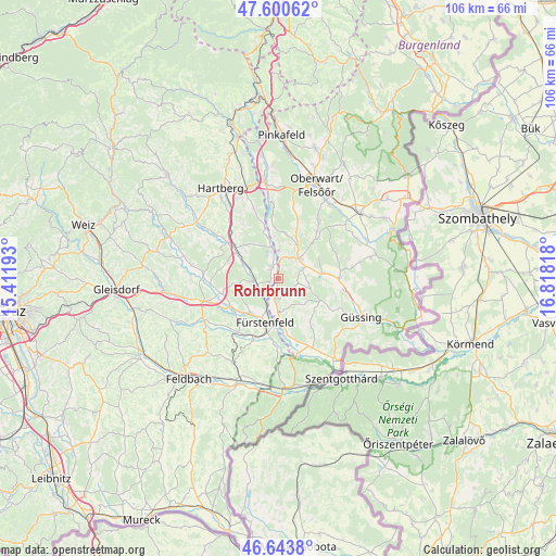
Rohrbrunn GPS coordinates[2]
47° 7' 27.696" North, 16° 6' 54.18" East
| Map corner | latitude | longitude |
|---|---|---|
| Upper-left | 47.60062°, | 15.41193° |
| Center: | 47.12436°, | 16.11505° |
| Lower-right: | 46.6438°, | 16.81818° |
| Map W x H: | 106.4×106.4 km | = 66.1×66.1mi |
| max Lat: | 48.98333° ⇑77.7% North |
| Rohrbrunn: | 47.12436° |
| min Lat: | ⇓22.3% South 46.48841° |
| min Long | Rohrbrunn | max Long |
| 9.57802° | 16.11505° | 17.1° |
| W 83.6%⇐ | ⇒16.4% E |
Elevation
Elevation of Rohrbrunn is 276 m = 906 ft, and this is 229.5 m = 753 ft below average elevation for this country.
| Max E: |
2140 m = 7021 ft | 79.7% |
| Avg. | 505.5 m = 1658 ft | |
| Rohrbrunn | 276 m = 906 ft | |
Min E: |
118 m = 387 ft | 20.3% |
See also: Austria elevation on elevation.city.
Geographical zone
Rohrbrunn is located in North temperate zone (between Tropic of Cancer and the Arctic Circle). Distance of this North polar circle is 2161.4 km =1343 mi to North.| Distance of | km | miles | from Rohrbrunn |
|---|---|---|---|
| North Pole | 4767.3 | 2962.3 | to North |
| Arctic Circle | 2161.4 | 1343 | to North |
| Tropic Cancer | 2633.8 | 1636.6 | to South |
| Equator | 5239.7 | 3255.8 | to South |


Nearby cities:
15 places around Rohrbrunn: (largest is in red/bold)
• Altenmarkt bei Fürstenfeld
8.2 km =5.1 mi,  218°
218°
• Bad Blumau
5 km =3.1 mi,  260°
260°
• Bocksdorf
5.2 km =3.2 mi,  66°
66°
• Burgau
2.5 km =1.6 mi,  325°
325°
• Burgauberg
2.7 km =1.7 mi,  13°
13°
• Deutsch Kaltenbrunn
3.5 km =2.2 mi,  159°
159°
• Heugraben
5.7 km =3.5 mi,  97°
97°
• Leitersdorf bei Hartberg
6.8 km =4.2 mi,  294°
294°
• Limbach im Burgenland
7.5 km =4.7 mi,  148°
148°
• Neudau
5.8 km =3.6 mi,  350°
350°
• Neudauberg
5.3 km =3.3 mi,  3°
3°
• Neusiedl bei Güssing
5.8 km =3.6 mi,  117°
117°
• Ollersdorf im Burgenland
7.6 km =4.7 mi,  30°
30°
• Rohr im Burgenland
4 km =2.5 mi, 102°
• Stegersbach
6.1 km =3.8 mi,  39°
39°
Sources, notices
• [Note1] Compared only with cities in Austria existing in our database
• [Src1] Map data: © OpenStreetMap contributors (CC-BY-SA)
• [Src2] Other city data from geonames.org with taken over terms of usage.
• [Src3] Geographical zone / Annual Mean Temperature by Robert A. Rohde @ Wikipedia
