Spielfeld geodata
Spielfeld (Styria) is a seat of a third-order administrative division; located in Austria in Europe/Vienna (GMT+2) time zone. With population of 698 people, there are 1862 cities with bigger population in this country. Compared to other cities in Austria, 95.1% of cities are located further ↑North; 70.2% of cities are located further ←West and 83% of cities have higher elevation than Spielfeld. Note1
Administrative division(s):
- Level 1: Styria
- Level 2: Politischer Bezirk Leibnitz
- Level 3: Straß-Spielfeld


Spielfeld GPS coordinates[2]
46° 42' 20.016" North, 15° 38' 13.992" East
| Map corner | latitude | longitude |
|---|---|---|
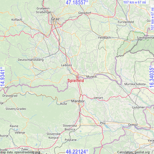
| Upper-left | 47.18557°, | 14.9341° |
| Center: | 46.70556°, | 15.63722° |
| Lower-right: | 46.22124°, | 16.34035° |
| Map W x H: | 107.2×107.2 km | = 66.6×66.6mi |
| max Lat: | 48.98333° ⇑95.1% North |
| Spielfeld: | 46.70556° |
| min Lat: | ⇓4.9% South 46.48841° |
| min Long | Spielfeld | max Long |
| 9.57802° | 15.63722° | 17.1° |
| W 70.2%⇐ | ⇒29.8% E |
Elevation
Elevation of Spielfeld is 258 m = 846 ft, and this is 247.5 m = 812 ft below average elevation for this country.
| Max E: |
2140 m = 7021 ft | 83% |
| Avg. | 505.5 m = 1658 ft | |
| Spielfeld | 258 m = 846 ft | |
Min E: |
118 m = 387 ft | 17% |
See also: Austria elevation on elevation.city.
Geographical zone
Spielfeld is located in North temperate zone (between Tropic of Cancer and the Arctic Circle). Distance of this North polar circle is 2208 km =1372 mi to North.| Distance of | km | miles | from Spielfeld |
|---|---|---|---|
| North Pole | 4813.9 | 2991.2 | to North |
| Arctic Circle | 2208 | 1372 | to North |
| Tropic Cancer | 2587.3 | 1607.7 | to South |
| Equator | 5193.2 | 3226.9 | to South |


Nearby cities:
15 places around Spielfeld: (largest is in red/bold)
• Ehrenhausen
4.4 km =2.7 mi,  298°
298°
• Eichfeld
10.2 km =6.3 mi,  77°
77°
• Gabersdorf
8.9 km =5.5 mi,  333°
333°
• Gamlitz
6.6 km =4.1 mi,  284°
284°
• Leitring
8.7 km =5.4 mi,  321°
321°
• Obervogau
5.9 km =3.7 mi, 317°
• Ratsch an der Weinstraße
5.4 km =3.4 mi,  250°
250°
• Retznei
6.2 km =3.9 mi, 299°
• Sankt Veit am Vogau
3.9 km =2.4 mi,  5°
5°
• Straß in Steiermark
2.6 km =1.6 mi,  337°
337°
• Sulztal an der Weinstraße
7.1 km =4.4 mi, 249°
• Vogau
3.7 km =2.3 mi, 323°
• Wagna
9 km =5.6 mi, 318°
• Weinburg am Saßbach
8.3 km =5.2 mi,  50°
50°
• Weitersfeld an der Mur
6.1 km =3.8 mi,  95°
95°
Sources, notices
• [Note1] Compared only with cities in Austria existing in our database
• [Src1] Map data: © OpenStreetMap contributors (CC-BY-SA)
• [Src2] Other city data from geonames.org with taken over terms of usage.
• [Src3] Geographical zone / Annual Mean Temperature by Robert A. Rohde @ Wikipedia
