Retznei geodata
Retznei (Styria) is a seat of a third-order administrative division; located in Austria in Europe/Vienna (GMT+2) time zone. With population of 365 people, there are 2664 cities with bigger population in this country. Compared to other cities in Austria, 94.1% of cities are located further ↑North; 67.2% of cities are located further ←West and 75.4% of cities have higher elevation than Retznei. Note1
Administrative division(s):
- Level 1: Styria
- Level 2: Politischer Bezirk Leibnitz
- Level 3: Ehrenhausen an der Weinstraße


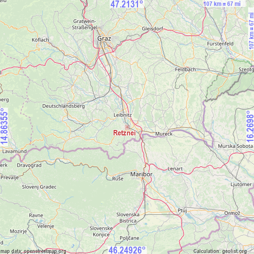
Retznei GPS coordinates[2]
46° 43' 59.988" North, 15° 34' 0.012" East
| Map corner | latitude | longitude |
|---|---|---|
| Upper-left | 47.2131°, | 14.86355° |
| Center: | 46.73333°, | 15.56667° |
| Lower-right: | 46.24926°, | 16.2698° |
| Map W x H: | 107.2×107.2 km | = 66.6×66.6mi |
| max Lat: | 48.98333° ⇑94.1% North |
| Retznei: | 46.73333° |
| min Lat: | ⇓5.9% South 46.48841° |
| min Long | Retznei | max Long |
| 9.57802° | 15.56667° | 17.1° |
| W 67.2%⇐ | ⇒32.8% E |
Elevation
Elevation of Retznei is 300 m = 984 ft, and this is 205.5 m = 674 ft below average elevation for this country.
| Max E: |
2140 m = 7021 ft | 75.4% |
| Avg. | 505.5 m = 1658 ft | |
| Retznei | 300 m = 984 ft | |
Min E: |
118 m = 387 ft | 24.6% |
See also: Austria elevation on elevation.city.
Geographical zone
Retznei is located in North temperate zone (between Tropic of Cancer and the Arctic Circle). Distance of this North polar circle is 2204.9 km =1370.1 mi to North.| Distance of | km | miles | from Retznei |
|---|---|---|---|
| North Pole | 4810.8 | 2989.3 | to North |
| Arctic Circle | 2204.9 | 1370.1 | to North |
| Tropic Cancer | 2590.3 | 1609.5 | to South |
| Equator | 5196.3 | 3228.8 | to South |


Nearby cities:
15 places around Retznei: (largest is in red/bold)
• Ehrenhausen
1.8 km =1.1 mi,  123°
123°
• Gabersdorf
5.1 km =3.2 mi,  15°
15°
• Gamlitz
1.8 km =1.1 mi,  215°
215°
• Heimschuh
6.3 km =3.9 mi,  297°
297°
• Leibnitz
5.8 km =3.6 mi,  338°
338°
• Leitring
3.7 km =2.3 mi,  0°
0°
• Obervogau
1.9 km =1.2 mi,  46°
46°
• Ratsch an der Weinstraße
4.9 km =3 mi,  176°
176°
• Sankt Veit am Vogau
5.8 km =3.6 mi,  82°
82°
• Seggauberg
5.3 km =3.3 mi,  314°
314°
• Spielfeld
6.2 km =3.9 mi, 119°
• Straß in Steiermark
4.5 km =2.8 mi,  98°
98°
• Sulztal an der Weinstraße
5.7 km =3.5 mi,  192°
192°
• Vogau
3.2 km =2 mi,  92°
92°
• Wagna
3.8 km =2.4 mi,  351°
351°
Sources, notices
• [Note1] Compared only with cities in Austria existing in our database
• [Src1] Map data: © OpenStreetMap contributors (CC-BY-SA)
• [Src2] Other city data from geonames.org with taken over terms of usage.
• [Src3] Geographical zone / Annual Mean Temperature by Robert A. Rohde @ Wikipedia
