Leitring geodata
Leitring (Styria) is a populated place; located in Austria in Europe/Vienna (GMT+2) time zone. With population of 3,132 people, there are 357 cities with bigger population in this country. Compared to other cities in Austria, 93% of cities are located further ↑North; 67.2% of cities are located further ←West and 82.1% of cities have higher elevation than Leitring. Note1


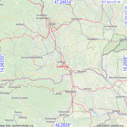
Leitring GPS coordinates[2]
46° 46' 0.012" North, 15° 34' 0.012" East
| Map corner | latitude | longitude |
|---|---|---|
| Upper-left | 47.24614°, | 14.86355° |
| Center: | 46.76667°, | 15.56667° |
| Lower-right: | 46.2829°, | 16.2698° |
| Map W x H: | 107.1×107.1 km | = 66.5×66.5mi |
| max Lat: | 48.98333° ⇑93% North |
| Leitring: | 46.76667° |
| min Lat: | ⇓7% South 46.48841° |
| min Long | Leitring | max Long |
| 9.57802° | 15.56667° | 17.1° |
| W 67.2%⇐ | ⇒32.8% E |
Elevation
Elevation of Leitring is 264 m = 866 ft, and this is 241.5 m = 792 ft below average elevation for this country.
| Max E: |
2140 m = 7021 ft | 82.1% |
| Avg. | 505.5 m = 1658 ft | |
| Leitring | 264 m = 866 ft | |
Min E: |
118 m = 387 ft | 17.9% |
See also: Austria elevation on elevation.city.
Geographical zone
Leitring is located in North temperate zone (between Tropic of Cancer and the Arctic Circle). Distance of this North polar circle is 2201.2 km =1367.8 mi to North.| Distance of | km | miles | from Leitring |
|---|---|---|---|
| North Pole | 4807.1 | 2987 | to North |
| Arctic Circle | 2201.2 | 1367.8 | to North |
| Tropic Cancer | 2594 | 1611.8 | to South |
| Equator | 5200 | 3231.1 | to South |


Nearby cities:
15 places around Leitring: (largest is in red/bold)
• Ehrenhausen
5 km =3.1 mi,  162°
162°
• Gabersdorf
1.8 km =1.1 mi,  48°
48°
• Gamlitz
5.3 km =3.3 mi,  191°
191°
• Gralla
5.3 km =3.3 mi,  350°
350°
• Heimschuh
5.7 km =3.5 mi,  262°
262°
• Kaindorf an der Sulm
3.6 km =2.2 mi,  323°
323°
• Leibnitz
2.7 km =1.7 mi,  307°
307°
• Neutillmitsch
6.1 km =3.8 mi,  335°
335°
• Obervogau
2.8 km =1.7 mi,  150°
150°
• Retznei
3.7 km =2.3 mi,  180°
180°
• Seggauberg
3.8 km =2.4 mi,  270°
270°
• Straß in Steiermark
6.2 km =3.9 mi,  134°
134°
• Tillmitsch Links der Laßnitz
5.8 km =3.6 mi,  325°
325°
• Vogau
5 km =3.1 mi,  140°
140°
• Wagna
0.6 km =0.4 mi, 271°
Sources, notices
• [Note1] Compared only with cities in Austria existing in our database
• [Src1] Map data: © OpenStreetMap contributors (CC-BY-SA)
• [Src2] Other city data from geonames.org with taken over terms of usage.
• [Src3] Geographical zone / Annual Mean Temperature by Robert A. Rohde @ Wikipedia
