Vogau geodata
Vogau (Styria) is a populated place; located in Austria in Europe/Vienna (GMT+2) time zone. With population of 1,133 people, there are 1121 cities with bigger population in this country. Compared to other cities in Austria, 94.2% of cities are located further ↑North; 69% of cities are located further ←West and 84% of cities have higher elevation than Vogau. Note1
Administrative division(s):
- Level 1: Styria
- Level 2: Politischer Bezirk Leibnitz
- Level 3: Straß-Spielfeld


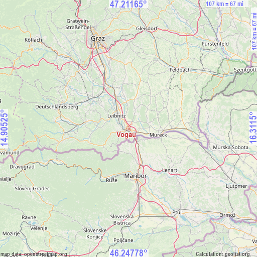
Vogau GPS coordinates[2]
46° 43' 54.732" North, 15° 36' 30.132" East
| Map corner | latitude | longitude |
|---|---|---|
| Upper-left | 47.21165°, | 14.90525° |
| Center: | 46.73187°, | 15.60837° |
| Lower-right: | 46.24778°, | 16.3115° |
| Map W x H: | 107.2×107.2 km | = 66.6×66.6mi |
| max Lat: | 48.98333° ⇑94.2% North |
| Vogau: | 46.73187° |
| min Lat: | ⇓5.8% South 46.48841° |
| min Long | Vogau | max Long |
| 9.57802° | 15.60837° | 17.1° |
| W 69%⇐ | ⇒31% E |
Elevation
Elevation of Vogau is 252 m = 827 ft, and this is 253.5 m = 832 ft below average elevation for this country.
| Max E: |
2140 m = 7021 ft | 84% |
| Avg. | 505.5 m = 1658 ft | |
| Vogau | 252 m = 827 ft | |
Min E: |
118 m = 387 ft | 16% |
See also: Austria elevation on elevation.city.
Geographical zone
Vogau is located in North temperate zone (between Tropic of Cancer and the Arctic Circle). Distance of this North polar circle is 2205.1 km =1370.2 mi to North.| Distance of | km | miles | from Vogau |
|---|---|---|---|
| North Pole | 4811 | 2989.4 | to North |
| Arctic Circle | 2205.1 | 1370.2 | to North |
| Tropic Cancer | 2590.2 | 1609.5 | to South |
| Equator | 5196.1 | 3228.7 | to South |


Nearby cities:
15 places around Vogau: (largest is in red/bold)
• Ehrenhausen
1.9 km =1.2 mi,  242°
242°
• Gabersdorf
5.4 km =3.4 mi,  339°
339°
• Gamlitz
4.4 km =2.7 mi,  252°
252°
• Kaindorf an der Sulm
8.6 km =5.3 mi,  321°
321°
• Leibnitz
7.7 km =4.8 mi, 316°
• Leitring
5 km =3.1 mi, 320°
• Obervogau
2.3 km =1.4 mi,  309°
309°
• Ratsch an der Weinstraße
5.5 km =3.4 mi,  211°
211°
• Retznei
3.2 km =2 mi,  272°
272°
• Sankt Veit am Vogau
2.7 km =1.7 mi,  69°
69°
• Seggauberg
8 km =5 mi,  298°
298°
• Spielfeld
3.7 km =2.3 mi,  143°
143°
• Straß in Steiermark
1.3 km =0.8 mi,  112°
112°
• Sulztal an der Weinstraße
7 km =4.3 mi,  219°
219°
• Wagna
5.4 km =3.4 mi, 315°
Sources, notices
• [Note1] Compared only with cities in Austria existing in our database
• [Src1] Map data: © OpenStreetMap contributors (CC-BY-SA)
• [Src2] Other city data from geonames.org with taken over terms of usage.
• [Src3] Geographical zone / Annual Mean Temperature by Robert A. Rohde @ Wikipedia
