Söchau geodata
Söchau (Styria) is a seat of a third-order administrative division; located in Austria in Europe/Vienna (GMT+2) time zone. With population of 724 people, there are 1793 cities with bigger population in this country. Compared to other cities in Austria, 82.8% of cities are located further ↑North; 80.7% of cities are located further ←West and 79.5% of cities have higher elevation than Söchau. Note1
Administrative division(s):
- Level 1: Styria
- Level 2: Politischer Bezirk Hartberg-Fürstenfeld
- Level 3: Söchau


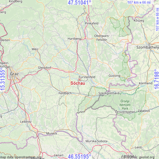
Söchau GPS coordinates[2]
47° 1' 59.988" North, 16° 1' 0.012" East
| Map corner | latitude | longitude |
|---|---|---|
| Upper-left | 47.51041°, | 15.31355° |
| Center: | 47.03333°, | 16.01667° |
| Lower-right: | 46.55195°, | 16.7198° |
| Map W x H: | 106.6×106.6 km | = 66.2×66.2mi |
| max Lat: | 48.98333° ⇑82.8% North |
| Söchau: | 47.03333° |
| min Lat: | ⇓17.2% South 46.48841° |
| min Long | Söchau | max Long |
| 9.57802° | 16.01667° | 17.1° |
| W 80.7%⇐ | ⇒19.3% E |
Elevation
Elevation of Söchau is 277 m = 909 ft, and this is 228.5 m = 750 ft below average elevation for this country.
| Max E: |
2140 m = 7021 ft | 79.5% |
| Avg. | 505.5 m = 1658 ft | |
| Söchau | 277 m = 909 ft | |
Min E: |
118 m = 387 ft | 20.5% |
See also: Austria elevation on elevation.city.
Geographical zone
Söchau is located in North temperate zone (between Tropic of Cancer and the Arctic Circle). Distance of this North polar circle is 2171.6 km =1349.4 mi to North.| Distance of | km | miles | from Söchau |
|---|---|---|---|
| North Pole | 4777.4 | 2968.5 | to North |
| Arctic Circle | 2171.6 | 1349.4 | to North |
| Tropic Cancer | 2623.7 | 1630.3 | to South |
| Equator | 5229.6 | 3249.5 | to South |


Nearby cities:
15 places around Söchau: (largest is in red/bold)
• Altenmarkt bei Fürstenfeld
4.4 km =2.7 mi,  32°
32°
• Breitenfeld an der Rittschein
5.1 km =3.2 mi,  270°
270°
• Brunn
9.3 km =5.8 mi,  180°
180°
• Dietersdorf bei Fürstenfeld
6.4 km =4 mi,  101°
101°
• Fürstenfeld
5.4 km =3.4 mi,  69°
69°
• Grosswilfersdorf
6.1 km =3.8 mi,  335°
335°
• Hatzendorf
6.4 km =4 mi,  190°
190°
• Ilz
9 km =5.6 mi,  310°
310°
• Loipersdorf bei Fürstenfeld
7.3 km =4.5 mi,  120°
120°
• Ottendorf an der Rittschein
9.2 km =5.7 mi,  279°
279°
• Riegersburg
7.5 km =4.7 mi,  240°
240°
• Rudersdorf
7.8 km =4.8 mi,  76°
76°
• Stein
6.6 km =4.1 mi,  126°
126°
• Unterlamm
7.2 km =4.5 mi,  150°
150°
• Übersbach
3.1 km =1.9 mi,  111°
111°
Sources, notices
• [Note1] Compared only with cities in Austria existing in our database
• [Src1] Map data: © OpenStreetMap contributors (CC-BY-SA)
• [Src2] Other city data from geonames.org with taken over terms of usage.
• [Src3] Geographical zone / Annual Mean Temperature by Robert A. Rohde @ Wikipedia
