Grosswilfersdorf geodata
Grosswilfersdorf (Styria) is a populated place; located in Austria in Europe/Vienna (GMT+2) time zone. With population of 692 people, there are 1877 cities with bigger population in this country. Compared to other cities in Austria, 80.3% of cities are located further ↑North; 79.8% of cities are located further ←West and 80% of cities have higher elevation than Grosswilfersdorf. Note1
Administrative division(s):
- Level 1: Styria
- Level 2: Politischer Bezirk Hartberg-Fürstenfeld
- Level 3: Großwilfersdorf


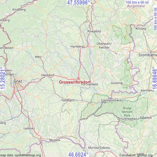
Grosswilfersdorf GPS coordinates[2]
47° 4' 59.988" North, 15° 58' 59.988" East
| Map corner | latitude | longitude |
|---|---|---|
| Upper-left | 47.55996°, | 15.28021° |
| Center: | 47.08333°, | 15.98333° |
| Lower-right: | 46.6024°, | 16.68646° |
| Map W x H: | 106.5×106.5 km | = 66.2×66.2mi |
| max Lat: | 48.98333° ⇑80.3% North |
| Grosswilfersdorf: | 47.08333° |
| min Lat: | ⇓19.7% South 46.48841° |
| min Long | Grosswilfersdor | max Long |
| 9.57802° | 15.98333° | 17.1° |
| W 79.8%⇐ | ⇒20.2% E |
Elevation
Elevation of Grosswilfersdorf is 275 m = 902 ft, and this is 230.5 m = 756 ft below average elevation for this country.
| Max E: |
2140 m = 7021 ft | 80% |
| Avg. | 505.5 m = 1658 ft | |
| Grosswilfersdorf | 275 m = 902 ft | |
Min E: |
118 m = 387 ft | 20% |
See also: Austria elevation on elevation.city.
Geographical zone
Grosswilfersdorf is located in North temperate zone (between Tropic of Cancer and the Arctic Circle). Distance of this North polar circle is 2166 km =1345.9 mi to North.| Distance of | km | miles | from Grosswilfersdorf |
|---|---|---|---|
| North Pole | 4771.9 | 2965.1 | to North |
| Arctic Circle | 2166 | 1345.9 | to North |
| Tropic Cancer | 2629.3 | 1633.8 | to South |
| Equator | 5235.2 | 3253 | to South |


Nearby cities:
15 places around Grosswilfersdorf: (largest is in red/bold)
• Altenmarkt bei Fürstenfeld
5.2 km =3.2 mi,  111°
111°
• Bad Blumau
6.3 km =3.9 mi,  53°
53°
• Bad Waltersdorf
9.8 km =6.1 mi,  11°
11°
• Breitenfeld an der Rittschein
6.1 km =3.8 mi,  204°
204°
• Fürstenfeld
8.4 km =5.2 mi,  116°
116°
• Gnies
10.3 km =6.4 mi,  280°
280°
• Grosshart
9.6 km =6 mi,  344°
344°
• Hainersdorf
4.6 km =2.9 mi,  319°
319°
• Ilz
4.3 km =2.7 mi,  274°
274°
• Leitersdorf bei Hartberg
8.3 km =5.2 mi,  27°
27°
• Nestelbach im Ilztal
8.8 km =5.5 mi, 270°
• Ottendorf an der Rittschein
7.7 km =4.8 mi,  238°
238°
• Riegersburg
10.1 km =6.3 mi, 203°
• Söchau
6.1 km =3.8 mi,  155°
155°
• Übersbach
8.6 km =5.3 mi,  140°
140°
Sources, notices
• [Note1] Compared only with cities in Austria existing in our database
• [Src1] Map data: © OpenStreetMap contributors (CC-BY-SA)
• [Src2] Other city data from geonames.org with taken over terms of usage.
• [Src3] Geographical zone / Annual Mean Temperature by Robert A. Rohde @ Wikipedia
