Ilz geodata
Ilz (Styria) is a seat of a third-order administrative division; located in Austria in Europe/Vienna (GMT+1) time zone. With population of 1,192 people, there are 1054 cities with bigger population in this country. Compared to other cities in Austria, 79.6% of cities are located further ↑North; 78.1% of cities are located further ←West and 77.2% of cities have higher elevation than Ilz. Note1
Administrative division(s):
- Level 1: Styria
- Level 2: Politischer Bezirk Hartberg-Fürstenfeld
- Level 3: Ilz


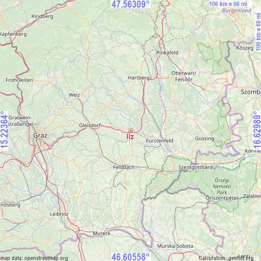
Ilz GPS coordinates[2]
47° 5' 11.364" North, 15° 55' 36.336" East
| Map corner | latitude | longitude |
|---|---|---|
| Upper-left | 47.56309°, | 15.22364° |
| Center: | 47.08649°, | 15.92676° |
| Lower-right: | 46.60558°, | 16.62989° |
| Map W x H: | 106.5×106.5 km | = 66.2×66.2mi |
| max Lat: | 48.98333° ⇑79.6% North |
| Ilz: | 47.08649° |
| min Lat: | ⇓20.4% South 46.48841° |
| min Long | Ilz | max Long |
| 9.57802° | 15.92676° | 17.1° |
| W 78.1%⇐ | ⇒21.9% E |
Elevation
Elevation of Ilz is 288 m = 945 ft, and this is 217.5 m = 714 ft below average elevation for this country.
| Max E: |
2140 m = 7021 ft | 77.2% |
| Avg. | 505.5 m = 1658 ft | |
| Ilz | 288 m = 945 ft | |
Min E: |
118 m = 387 ft | 22.8% |
See also: Austria elevation on elevation.city.
Geographical zone
Ilz is located in North temperate zone (between Tropic of Cancer and the Arctic Circle). Distance of this North polar circle is 2165.6 km =1345.6 mi to North.| Distance of | km | miles | from Ilz |
|---|---|---|---|
| North Pole | 4771.5 | 2964.9 | to North |
| Arctic Circle | 2165.6 | 1345.6 | to North |
| Tropic Cancer | 2629.6 | 1634 | to South |
| Equator | 5235.5 | 3253.2 | to South |


Nearby cities:
15 places around Ilz: (largest is in red/bold)
• Altenmarkt bei Fürstenfeld
9.4 km =5.8 mi,  103°
103°
• Auersbach
9 km =5.6 mi,  210°
210°
• Breitenfeld an der Rittschein
6.2 km =3.9 mi,  163°
163°
• Egelsdorf
9 km =5.6 mi,  291°
291°
• Gnies
6 km =3.7 mi,  284°
284°
• Grosshart
9.1 km =5.7 mi,  11°
11°
• Grosssteinbach
7.8 km =4.8 mi,  335°
335°
• Grosswilfersdorf
4.3 km =2.7 mi,  94°
94°
• Hainersdorf
3.4 km =2.1 mi,  22°
22°
• Hartmannsdorf
7.5 km =4.7 mi,  241°
241°
• Nestelbach im Ilztal
4.6 km =2.9 mi,  265°
265°
• Ottendorf an der Rittschein
5 km =3.1 mi, 207°
• Sinabelkirchen
7.7 km =4.8 mi, 282°
• Söchau
9 km =5.6 mi,  130°
130°
• Untergroßau
8.9 km =5.5 mi, 280°
Sources, notices
• [Note1] Compared only with cities in Austria existing in our database
• [Src1] Map data: © OpenStreetMap contributors (CC-BY-SA)
• [Src2] Other city data from geonames.org with taken over terms of usage.
• [Src3] Geographical zone / Annual Mean Temperature by Robert A. Rohde @ Wikipedia
