Frankenmarkt geodata
Frankenmarkt (Upper Austria) is a seat of a third-order administrative division; located in Austria in Europe/Vienna (GMT+2) time zone. With population of 2,185 people, there are 559 cities with bigger population in this country. Compared to other cities in Austria, 65.1% of cities are located further ↓South; 76.4% of cities are located further →East and 62.3% of cities have lower elevation than Frankenmarkt. Note1
Administrative division(s):
- Level 1: Upper Austria
- Level 2: Politischer Bezirk Vöcklabruck
- Level 3: Frankenmarkt


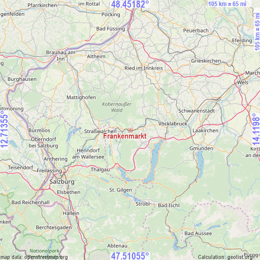
Frankenmarkt GPS coordinates[2]
47° 58' 59.988" North, 13° 25' 0.012" East
| Map corner | latitude | longitude |
|---|---|---|
| Upper-left | 48.45182°, | 12.71355° |
| Center: | 47.98333°, | 13.41667° |
| Lower-right: | 47.51055°, | 14.1198° |
| Map W x H: | 104.7×104.7 km | = 65.1×65.1mi |
| max Lat: | 48.98333° ⇑34.9% North |
| Frankenmarkt: | 47.98333° |
| min Lat: | ⇓65.1% South 46.48841° |
| min Long | Frankenmarkt | max Long |
| 9.57802° | 13.41667° | 17.1° |
| W 23.6%⇐ | ⇒76.4% E |
Elevation
Elevation of Frankenmarkt is 534 m = 1752 ft, and this is 28.5 m = 94 ft above average elevation for this country.
| Max E: |
2140 m = 7021 ft | 37.7% |
| Frankenmarkt | 534 m 1752 ft | |
| Avg. | 505.5 m = 1658 ft | |
Min E: |
118 m = 387 ft | 62.3% |
See also: Austria elevation on elevation.city.
Geographical zone
Frankenmarkt is located in North temperate zone (between Tropic of Cancer and the Arctic Circle). Distance of this North polar circle is 2065.9 km =1283.7 mi to North.| Distance of | km | miles | from Frankenmarkt |
|---|---|---|---|
| North Pole | 4671.8 | 2902.9 | to North |
| Arctic Circle | 2065.9 | 1283.7 | to North |
| Tropic Cancer | 2729.3 | 1695.9 | to South |
| Equator | 5335.2 | 3315.1 | to South |


Nearby cities:
15 places around Frankenmarkt: (largest is in red/bold)
• Attersee
11.8 km =7.3 mi,  129°
129°
• Fornach
4.5 km =2.8 mi,  12°
12°
• Frankenburg
10.9 km =6.8 mi,  30°
30°
• Gampern
10.3 km =6.4 mi,  86°
86°
• Irrsdorf
10.1 km =6.3 mi,  259°
259°
• Neukirchen an der Vöckla
11 km =6.8 mi,  54°
54°
• Oberhofen am Irrsee
9.4 km =5.8 mi,  246°
246°
• Pfaffing
5.8 km =3.6 mi, 48°
• Redleiten
11.6 km =7.2 mi,  19°
19°
• Sankt Georgen im Attergau
7.2 km =4.5 mi,  136°
136°
• Schneegattern
10.2 km =6.3 mi,  296°
296°
• Steindorf
11.7 km =7.3 mi,  101°
101°
• Vöcklamarkt
5.4 km =3.4 mi,  66°
66°
• Weißenkirchen im Attergau
3.7 km =2.3 mi,  177°
177°
• Zell am Moos
11.9 km =7.4 mi,  218°
218°
Sources, notices
• [Note1] Compared only with cities in Austria existing in our database
• [Src1] Map data: © OpenStreetMap contributors (CC-BY-SA)
• [Src2] Other city data from geonames.org with taken over terms of usage.
• [Src3] Geographical zone / Annual Mean Temperature by Robert A. Rohde @ Wikipedia
