Schlatt geodata
Schlatt (Upper Austria) is a seat of a third-order administrative division; located in Austria in Europe/Vienna (GMT+2) time zone. With population of 167 people, there are 2885 cities with bigger population in this country. Compared to other cities in Austria, 70.8% of cities are located further ↓South; 69.3% of cities are located further →East and 57.2% of cities have higher elevation than Schlatt. Note1
Administrative division(s):
- Level 1: Upper Austria
- Level 2: Politischer Bezirk Vöcklabruck
- Level 3: Schlatt


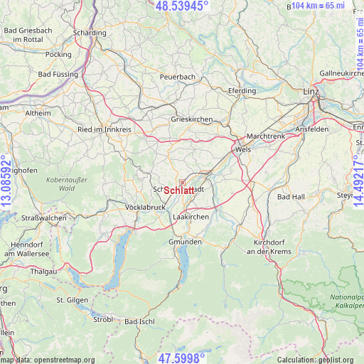
Schlatt GPS coordinates[2]
48° 4' 18.372" North, 13° 47' 20.544" East
| Map corner | latitude | longitude |
|---|---|---|
| Upper-left | 48.53945°, | 13.08592° |
| Center: | 48.07177°, | 13.78904° |
| Lower-right: | 47.5998°, | 14.49217° |
| Map W x H: | 104.5×104.5 km | = 64.9×64.9mi |
| max Lat: | 48.98333° ⇑29.2% North |
| Schlatt: | 48.07177° |
| min Lat: | ⇓70.8% South 46.48841° |
| min Long | Schlatt | max Long |
| 9.57802° | 13.78904° | 17.1° |
| W 30.7%⇐ | ⇒69.3% E |
Elevation
Elevation of Schlatt is 404 m = 1325 ft, and this is 101.5 m = 333 ft below average elevation for this country.
| Max E: |
2140 m = 7021 ft | 57.2% |
| Avg. | 505.5 m = 1658 ft | |
| Schlatt | 404 m = 1325 ft | |
Min E: |
118 m = 387 ft | 42.8% |
See also: Austria elevation on elevation.city.
Geographical zone
Schlatt is located in North temperate zone (between Tropic of Cancer and the Arctic Circle). Distance of this North polar circle is 2056.1 km =1277.6 mi to North.| Distance of | km | miles | from Schlatt |
|---|---|---|---|
| North Pole | 4662 | 2896.8 | to North |
| Arctic Circle | 2056.1 | 1277.6 | to North |
| Tropic Cancer | 2739.2 | 1702.1 | to South |
| Equator | 5345.1 | 3321.3 | to South |


Nearby cities:
15 places around Schlatt: (largest is in red/bold)
• Aichkirchen
4.2 km =2.6 mi,  2°
2°
• Desselbrunn
5.8 km =3.6 mi,  194°
194°
• Kaufing
2 km =1.2 mi,  156°
156°
• Neukirchen bei Lambach
3.8 km =2.4 mi,  33°
33°
• Niederthalheim
3.4 km =2.1 mi,  333°
333°
• Oberndorf bei Schwanenstadt
3 km =1.9 mi,  233°
233°
• Pitzenberg
4.8 km =3 mi,  272°
272°
• Redlham
6.1 km =3.8 mi,  210°
210°
• Roitham
5.8 km =3.6 mi, 155°
• Rutzenham
5.4 km =3.4 mi,  256°
256°
• Rüstorf
3.2 km =2 mi,  178°
178°
• Schwanenstadt
2.1 km =1.3 mi, 209°
• Stadl-Hausruck
4.8 km =3 mi,  75°
75°
• Stadl-Paura
5.9 km =3.7 mi, 77°
• Stadl-Traun
5.4 km =3.4 mi, 80°
Sources, notices
• [Note1] Compared only with cities in Austria existing in our database
• [Src1] Map data: © OpenStreetMap contributors (CC-BY-SA)
• [Src2] Other city data from geonames.org with taken over terms of usage.
• [Src3] Geographical zone / Annual Mean Temperature by Robert A. Rohde @ Wikipedia
