Scheibbs geodata
Scheibbs (Lower Austria) is a seat of a third-order administrative division; located in Austria in Europe/Vienna (GMT+2) time zone. With population of 4,196 people, there are 241 cities with bigger population in this country. Compared to other cities in Austria, 66.5% of cities are located further ↓South; 57.2% of cities are located further ←West and 66.6% of cities have higher elevation than Scheibbs. Note1
Administrative division(s):
- Level 1: Lower Austria
- Level 2: Politischer Bezirk Scheibbs
- Level 3: Scheibbs


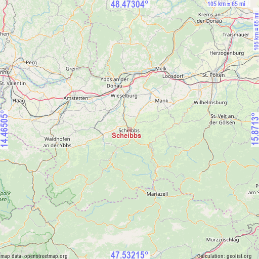
Scheibbs GPS coordinates[2]
48° 0' 17.064" North, 15° 10' 5.412" East
| Map corner | latitude | longitude |
|---|---|---|
| Upper-left | 48.47304°, | 14.46505° |
| Center: | 48.00474°, | 15.16817° |
| Lower-right: | 47.53215°, | 15.8713° |
| Map W x H: | 104.6×104.6 km | = 65×65mi |
| max Lat: | 48.98333° ⇑33.5% North |
| Scheibbs: | 48.00474° |
| min Lat: | ⇓66.5% South 46.48841° |
| min Long | Scheibbs | max Long |
| 9.57802° | 15.16817° | 17.1° |
| W 57.2%⇐ | ⇒42.8% E |
Elevation
Elevation of Scheibbs is 344 m = 1129 ft, and this is 161.5 m = 530 ft below average elevation for this country.
| Max E: |
2140 m = 7021 ft | 66.6% |
| Avg. | 505.5 m = 1658 ft | |
| Scheibbs | 344 m = 1129 ft | |
Min E: |
118 m = 387 ft | 33.4% |
See also: Austria elevation on elevation.city.
Geographical zone
Scheibbs is located in North temperate zone (between Tropic of Cancer and the Arctic Circle). Distance of this North polar circle is 2063.5 km =1282.2 mi to North.| Distance of | km | miles | from Scheibbs |
|---|---|---|---|
| North Pole | 4669.4 | 2901.4 | to North |
| Arctic Circle | 2063.5 | 1282.2 | to North |
| Tropic Cancer | 2731.7 | 1697.4 | to South |
| Equator | 5337.6 | 3316.6 | to South |


Nearby cities:
15 places around Scheibbs: (largest is in red/bold)
• Frankenfels
12 km =7.5 mi,  101°
101°
• Gaming
10.3 km =6.4 mi,  215°
215°
• Gresten
10.8 km =6.7 mi,  258°
258°
• Gries bei Oberndorf
7.5 km =4.7 mi,  26°
26°
• Höfling
11.2 km =7 mi,  299°
299°
• Mühling
11.1 km =6.9 mi,  346°
346°
• Oberndorf an der Melk
7.8 km =4.8 mi, 32°
• Puchenstuben
12.3 km =7.6 mi,  133°
133°
• Purgstall
6.5 km =4 mi,  337°
337°
• Reinsberg
7.6 km =4.7 mi,  253°
253°
• Sankt Georgen an der Leys
5.3 km =3.3 mi,  55°
55°
• Steinakirchen am Forst
11.5 km =7.1 mi,  308°
308°
• Unteramt
9.6 km =6 mi,  265°
265°
• Wang
11.4 km =7.1 mi,  293°
293°
• Wolfpassing
11.2 km =7 mi,  316°
316°
Sources, notices
• [Note1] Compared only with cities in Austria existing in our database
• [Src1] Map data: © OpenStreetMap contributors (CC-BY-SA)
• [Src2] Other city data from geonames.org with taken over terms of usage.
• [Src3] Geographical zone / Annual Mean Temperature by Robert A. Rohde @ Wikipedia
