Gresten geodata
Gresten (Lower Austria) is a seat of a third-order administrative division; located in Austria in Europe/Vienna (GMT+2) time zone. With population of 1,695 people, there are 739 cities with bigger population in this country. Compared to other cities in Austria, 65.3% of cities are located further ↓South; 54.6% of cities are located further ←West and 56.6% of cities have higher elevation than Gresten. Note1
Administrative division(s):
- Level 1: Lower Austria
- Level 2: Politischer Bezirk Scheibbs
- Level 3: Gresten


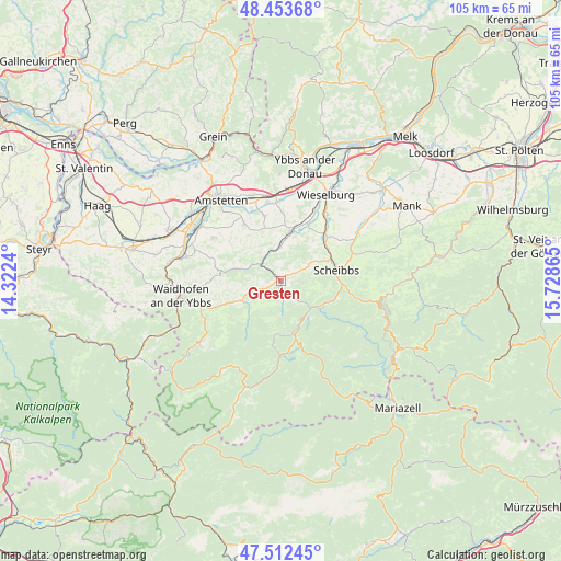
Gresten GPS coordinates[2]
47° 59' 6.756" North, 15° 1' 31.872" East
| Map corner | latitude | longitude |
|---|---|---|
| Upper-left | 48.45368°, | 14.3224° |
| Center: | 47.98521°, | 15.02552° |
| Lower-right: | 47.51245°, | 15.72865° |
| Map W x H: | 104.7×104.7 km | = 65.1×65.1mi |
| max Lat: | 48.98333° ⇑34.7% North |
| Gresten: | 47.98521° |
| min Lat: | ⇓65.3% South 46.48841° |
| min Long | Gresten | max Long |
| 9.57802° | 15.02552° | 17.1° |
| W 54.6%⇐ | ⇒45.4% E |
Elevation
Elevation of Gresten is 408 m = 1339 ft, and this is 97.5 m = 320 ft below average elevation for this country.
| Max E: |
2140 m = 7021 ft | 56.6% |
| Avg. | 505.5 m = 1658 ft | |
| Gresten | 408 m = 1339 ft | |
Min E: |
118 m = 387 ft | 43.4% |
See also: Austria elevation on elevation.city.
Geographical zone
Gresten is located in North temperate zone (between Tropic of Cancer and the Arctic Circle). Distance of this North polar circle is 2065.7 km =1283.6 mi to North.| Distance of | km | miles | from Gresten |
|---|---|---|---|
| North Pole | 4671.6 | 2902.8 | to North |
| Arctic Circle | 2065.7 | 1283.6 | to North |
| Tropic Cancer | 2729.5 | 1696 | to South |
| Equator | 5335.5 | 3315.3 | to South |


Nearby cities:
15 places around Gresten: (largest is in red/bold)
• Euratsfeld
12.8 km =8 mi,  326°
326°
• Ferschnitz
12.5 km =7.8 mi,  345°
345°
• Gaming
7.8 km =4.8 mi,  143°
143°
• Höfling
7.7 km =4.8 mi,  6°
6°
• Lunz am See
13.8 km =8.6 mi,  178°
178°
• Neuhofen an der Ybbs
15 km =9.3 mi,  302°
302°
• Purgstall
11.5 km =7.1 mi,  44°
44°
• Randegg
4.9 km =3 mi,  307°
307°
• Reinsberg
3.4 km =2.1 mi,  89°
89°
• Scheibbs
10.8 km =6.7 mi,  78°
78°
• Steinakirchen am Forst
9.5 km =5.9 mi, 10°
• Unteramt
1.7 km =1.1 mi, 35°
• Wang
6.7 km =4.2 mi,  0°
0°
• Wolfpassing
10.7 km =6.6 mi,  15°
15°
• Ybbsitz
10.8 km =6.7 mi,  247°
247°
Sources, notices
• [Note1] Compared only with cities in Austria existing in our database
• [Src1] Map data: © OpenStreetMap contributors (CC-BY-SA)
• [Src2] Other city data from geonames.org with taken over terms of usage.
• [Src3] Geographical zone / Annual Mean Temperature by Robert A. Rohde @ Wikipedia
