Limbach im Burgenland geodata
Limbach im Burgenland (Burgenland) is a populated place; located in Austria in Europe/Vienna (GMT+2) time zone. With population of 569 people, there are 2249 cities with bigger population in this country. Compared to other cities in Austria, 81.3% of cities are located further ↑North; 85% of cities are located further ←West and 68.1% of cities have higher elevation than Limbach im Burgenland. Note1
Administrative division(s):
- Level 1: Burgenland
- Level 2: Politischer Bezirk Güssing
- Level 3: Kukmirn


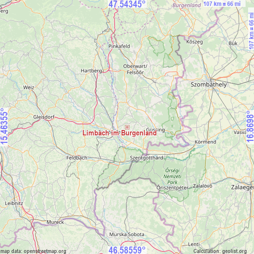
Limbach im Burgenland GPS coordinates[2]
47° 4' 0.012" North, 16° 10' 0.012" East
| Map corner | latitude | longitude |
|---|---|---|
| Upper-left | 47.54345°, | 15.46355° |
| Center: | 47.06667°, | 16.16667° |
| Lower-right: | 46.58559°, | 16.8698° |
| Map W x H: | 106.5×106.5 km | = 66.2×66.2mi |
| max Lat: | 48.98333° ⇑81.3% North |
| Limbach im Burgenland: | 47.06667° |
| min Lat: | ⇓18.7% South 46.48841° |
| min Long | Limbach im Burg | max Long |
| 9.57802° | 16.16667° | 17.1° |
| W 85%⇐ | ⇒15% E |
Elevation
Elevation of Limbach im Burgenland is 338 m = 1109 ft, and this is 167.5 m = 550 ft below average elevation for this country.
| Max E: |
2140 m = 7021 ft | 68.1% |
| Avg. | 505.5 m = 1658 ft | |
| Limbach im Burgenland | 338 m = 1109 ft | |
Min E: |
118 m = 387 ft | 31.9% |
See also: Austria elevation on elevation.city.
Geographical zone
Limbach im Burgenland is located in North temperate zone (between Tropic of Cancer and the Arctic Circle). Distance of this North polar circle is 2167.9 km =1347.1 mi to North.| Distance of | km | miles | from Limbach im Burgenland |
|---|---|---|---|
| North Pole | 4773.7 | 2966.2 | to North |
| Arctic Circle | 2167.9 | 1347.1 | to North |
| Tropic Cancer | 2627.4 | 1632.6 | to South |
| Equator | 5233.3 | 3251.8 | to South |


Nearby cities:
15 places around Limbach im Burgenland: (largest is in red/bold)
• Altenmarkt bei Fürstenfeld
9 km =5.6 mi,  269°
269°
• Bocksdorf
8.5 km =5.3 mi,  5°
5°
• Deutsch Kaltenbrunn
4.1 km =2.5 mi,  319°
319°
• Dietersdorf bei Fürstenfeld
7.1 km =4.4 mi,  225°
225°
• Eltendorf
7 km =4.3 mi,  157°
157°
• Fürstenfeld
6.6 km =4.1 mi,  253°
253°
• Heugraben
6 km =3.7 mi,  17°
17°
• Kukmirn
3.4 km =2.1 mi,  73°
73°
• Königsdorf
7.4 km =4.6 mi,  180°
180°
• Loipersdorf bei Fürstenfeld
9 km =5.6 mi,  214°
214°
• Neusiedl bei Güssing
3.9 km =2.4 mi, 18°
• Neustift bei Güssing
8.5 km =5.3 mi,  123°
123°
• Rohr im Burgenland
5.6 km =3.5 mi,  0°
0°
• Rohrbrunn
7.5 km =4.7 mi,  328°
328°
• Rudersdorf
4.2 km =2.6 mi,  243°
243°
Sources, notices
• [Note1] Compared only with cities in Austria existing in our database
• [Src1] Map data: © OpenStreetMap contributors (CC-BY-SA)
• [Src2] Other city data from geonames.org with taken over terms of usage.
• [Src3] Geographical zone / Annual Mean Temperature by Robert A. Rohde @ Wikipedia
