Reichenfels geodata
Reichenfels (Carinthia) is a seat of a third-order administrative division; located in Austria in Europe/Vienna (GMT+2) time zone. With population of 1,060 people, there are 1206 cities with bigger population in this country. Compared to other cities in Austria, 83.9% of cities are located further ↑North; 50.4% of cities are located further ←West and 85.2% of cities have lower elevation than Reichenfels. Note1
Administrative division(s):
- Level 1: Carinthia
- Level 2: Politischer Bezirk Wolfsberg
- Level 3: Reichenfels


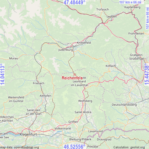
Reichenfels GPS coordinates[2]
47° 0' 25.848" North, 14° 44' 39.3" East
| Map corner | latitude | longitude |
|---|---|---|
| Upper-left | 47.48449°, | 14.04113° |
| Center: | 47.00718°, | 14.74425° |
| Lower-right: | 46.52556°, | 15.44738° |
| Map W x H: | 106.6×106.6 km | = 66.2×66.2mi |
| max Lat: | 48.98333° ⇑83.9% North |
| Reichenfels: | 47.00718° |
| min Lat: | ⇓16.1% South 46.48841° |
| min Long | Reichenfels | max Long |
| 9.57802° | 14.74425° | 17.1° |
| W 50.4%⇐ | ⇒49.6% E |
Elevation
Elevation of Reichenfels is 798 m = 2618 ft, and this is 292.5 m = 960 ft above average elevation for this country.
| Max E: |
2140 m = 7021 ft | 14.8% |
| Reichenfels | 798 m 2618 ft | |
| Avg. | 505.5 m = 1658 ft | |
Min E: |
118 m = 387 ft | 85.2% |
See also: Austria elevation on elevation.city.
Geographical zone
Reichenfels is located in North temperate zone (between Tropic of Cancer and the Arctic Circle). Distance of this North polar circle is 2174.5 km =1351.2 mi to North.| Distance of | km | miles | from Reichenfels |
|---|---|---|---|
| North Pole | 4780.4 | 2970.4 | to North |
| Arctic Circle | 2174.5 | 1351.2 | to North |
| Tropic Cancer | 2620.8 | 1628.5 | to South |
| Equator | 5226.7 | 3247.7 | to South |


Nearby cities:
15 places around Reichenfels: (largest is in red/bold)
• Auen
14.8 km =9.2 mi,  158°
158°
• Bad Sankt Leonhard im Lavanttal
6.1 km =3.8 mi,  143°
143°
• Eppenstein
13.5 km =8.4 mi,  357°
357°
• Hirschegg Rein
16.1 km =10 mi,  84°
84°
• Hüttenberg
16.5 km =10.3 mi,  243°
243°
• Kleinlobming
17.7 km =11 mi,  26°
26°
• Kliening
6.6 km =4.1 mi,  165°
165°
• Mühlen
18.1 km =11.2 mi,  278°
278°
• Obdach
8.1 km =5 mi,  325°
325°
• Oberweg
18 km =11.2 mi, 332°
• Preitenegg
15.7 km =9.8 mi,  118°
118°
• Reifling
15.2 km =9.4 mi,  337°
337°
• Sankt Margarethen im Lavanttal
18 km =11.2 mi, 166°
• Weißkirchen in Steiermark
15.9 km =9.9 mi, 357°
• Zellach
17.6 km =10.9 mi,  152°
152°
Sources, notices
• [Note1] Compared only with cities in Austria existing in our database
• [Src1] Map data: © OpenStreetMap contributors (CC-BY-SA)
• [Src2] Other city data from geonames.org with taken over terms of usage.
• [Src3] Geographical zone / Annual Mean Temperature by Robert A. Rohde @ Wikipedia
