Stall geodata
Stall (Carinthia) is a seat of a third-order administrative division; located in Austria in Europe/Vienna (GMT+2) time zone. With population of 505 people, there are 2495 cities with bigger population in this country. Compared to other cities in Austria, 88.1% of cities are located further ↑North; 82.5% of cities are located further →East and 93.2% of cities have lower elevation than Stall. Note1
Administrative division(s):
- Level 1: Carinthia
- Level 2: Politischer Bezirk Spittal an der Drau
- Level 3: Stall


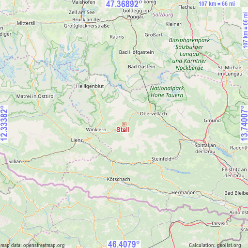
Stall GPS coordinates[2]
46° 53' 26.016" North, 13° 2' 12.984" East
| Map corner | latitude | longitude |
|---|---|---|
| Upper-left | 47.36892°, | 12.33382° |
| Center: | 46.89056°, | 13.03694° |
| Lower-right: | 46.4079°, | 13.74007° |
| Map W x H: | 106.9×106.9 km | = 66.4×66.4mi |
| max Lat: | 48.98333° ⇑88.1% North |
| Stall: | 46.89056° |
| min Lat: | ⇓11.9% South 46.48841° |
| min Long | Stall | max Long |
| 9.57802° | 13.03694° | 17.1° |
| W 17.5%⇐ | ⇒82.5% E |
Elevation
Elevation of Stall is 967 m = 3173 ft, and this is 461.5 m = 1514 ft above average elevation for this country.
| Max E: |
2140 m = 7021 ft | 6.8% |
| Stall | 967 m 3173 ft | |
| Avg. | 505.5 m = 1658 ft | |
Min E: |
118 m = 387 ft | 93.2% |
See also: Austria elevation on elevation.city.
Geographical zone
Stall is located in North temperate zone (between Tropic of Cancer and the Arctic Circle). Distance of this North polar circle is 2187.4 km =1359.2 mi to North.| Distance of | km | miles | from Stall |
|---|---|---|---|
| North Pole | 4793.3 | 2978.4 | to North |
| Arctic Circle | 2187.4 | 1359.2 | to North |
| Tropic Cancer | 2607.8 | 1620.4 | to South |
| Equator | 5213.7 | 3239.6 | to South |


Nearby cities:
15 places around Stall: (largest is in red/bold)
• Berg
17.3 km =10.7 mi,  155°
155°
• Berg im Drautal
17.4 km =10.8 mi,  154°
154°
• Debant
17.9 km =11.1 mi,  249°
249°
• Dellach im Drautal
17.3 km =10.7 mi,  169°
169°
• Dölsach
16.1 km =10 mi,  244°
244°
• Flattach
9.1 km =5.7 mi,  54°
54°
• Großkirchheim
14.1 km =8.8 mi,  310°
310°
• Irschen
14.9 km =9.3 mi,  183°
183°
• Lavant
18.2 km =11.3 mi, 236°
• Mörtschach
9.8 km =6.1 mi,  292°
292°
• Nikolsdorf
15 km =9.3 mi,  218°
218°
• Oberdrauburg
17.2 km =10.7 mi,  197°
197°
• Obervellach
13.7 km =8.5 mi,  68°
68°
• Rangersdorf
7.5 km =4.7 mi, 242°
• Winklern
12.5 km =7.8 mi,  261°
261°
Sources, notices
• [Note1] Compared only with cities in Austria existing in our database
• [Src1] Map data: © OpenStreetMap contributors (CC-BY-SA)
• [Src2] Other city data from geonames.org with taken over terms of usage.
• [Src3] Geographical zone / Annual Mean Temperature by Robert A. Rohde @ Wikipedia
