Ramingstein geodata
Ramingstein (Salzburg) is a seat of a third-order administrative division; located in Austria in Europe/Vienna (GMT+2) time zone. With population of 553 people, there are 2307 cities with bigger population in this country. Compared to other cities in Austria, 80.5% of cities are located further ↑North; 68.3% of cities are located further →East and 93.8% of cities have lower elevation than Ramingstein. Note1
Administrative division(s):
- Level 1: Salzburg
- Level 2: Politischer Bezirk Tamsweg
- Level 3: Ramingstein


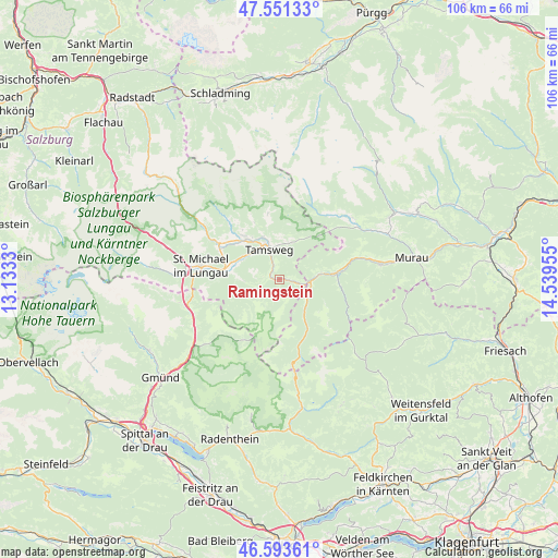
Ramingstein GPS coordinates[2]
47° 4' 28.632" North, 13° 50' 11.112" East
| Map corner | latitude | longitude |
|---|---|---|
| Upper-left | 47.55133°, | 13.1333° |
| Center: | 47.07462°, | 13.83642° |
| Lower-right: | 46.59361°, | 14.53955° |
| Map W x H: | 106.5×106.5 km | = 66.2×66.2mi |
| max Lat: | 48.98333° ⇑80.5% North |
| Ramingstein: | 47.07462° |
| min Lat: | ⇓19.5% South 46.48841° |
| min Long | Ramingstein | max Long |
| 9.57802° | 13.83642° | 17.1° |
| W 31.7%⇐ | ⇒68.3% E |
Elevation
Elevation of Ramingstein is 978 m = 3209 ft, and this is 472.5 m = 1550 ft above average elevation for this country.
| Max E: |
2140 m = 7021 ft | 6.2% |
| Ramingstein | 978 m 3209 ft | |
| Avg. | 505.5 m = 1658 ft | |
Min E: |
118 m = 387 ft | 93.8% |
See also: Austria elevation on elevation.city.
Geographical zone
Ramingstein is located in North temperate zone (between Tropic of Cancer and the Arctic Circle). Distance of this North polar circle is 2167 km =1346.5 mi to North.| Distance of | km | miles | from Ramingstein |
|---|---|---|---|
| North Pole | 4772.9 | 2965.7 | to North |
| Arctic Circle | 2167 | 1346.5 | to North |
| Tropic Cancer | 2628.3 | 1633.1 | to South |
| Equator | 5234.2 | 3252.4 | to South |


Nearby cities:
15 places around Ramingstein: (largest is in red/bold)
• Krakauhintermühlen
16.4 km =10.2 mi,  42°
42°
• Krakauschatten
15.6 km =9.7 mi, 39°
• Mariapfarr
10.6 km =6.6 mi,  322°
322°
• Mauterndorf
13.7 km =8.5 mi,  299°
299°
• Mörtelsdorf
7.1 km =4.4 mi,  329°
329°
• Rennweg am Katschberg
17.9 km =11.1 mi,  248°
248°
• Sankt Andrä im Lungau
9.3 km =5.8 mi, 334°
• Sankt Margarethen im Lungau
10.6 km =6.6 mi,  272°
272°
• Sankt Martin
14.4 km =8.9 mi,  281°
281°
• Sankt Michael im Lungau
15.6 km =9.7 mi, 280°
• St. Ruprecht-Falkendorf
14 km =8.7 mi,  77°
77°
• Stadl an der Mur
9.9 km =6.2 mi, 84°
• Tamsweg
6.2 km =3.9 mi,  342°
342°
• Thomatal
6.6 km =4.1 mi,  262°
262°
• Unternberg
8.3 km =5.2 mi, 300°
Sources, notices
• [Note1] Compared only with cities in Austria existing in our database
• [Src1] Map data: © OpenStreetMap contributors (CC-BY-SA)
• [Src2] Other city data from geonames.org with taken over terms of usage.
• [Src3] Geographical zone / Annual Mean Temperature by Robert A. Rohde @ Wikipedia
