Sankt Michael im Lungau geodata
Sankt Michael im Lungau (Salzburg) is a seat of a third-order administrative division; located in Austria in Europe/Vienna (GMT+2) time zone. With population of 2,059 people, there are 594 cities with bigger population in this country. Compared to other cities in Austria, 79.3% of cities are located further ↑North; 72.8% of cities are located further →East and 96.3% of cities have lower elevation than Sankt Michael im Lungau. Note1
Administrative division(s):
- Level 1: Salzburg
- Level 2: Politischer Bezirk Tamsweg
- Level 3: Sankt Michael im Lungau
Current local time in Sankt Michael im Lungau:
10:35 PM, FridayDifference from your time zone: hours


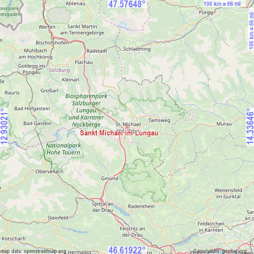
Sankt Michael im Lungau GPS coordinates[2]
47° 6' 0" North, 13° 37' 59.988" East
| Map corner | latitude | longitude |
|---|---|---|
| Upper-left | 47.57648°, | 12.93021° |
| Center: | 47.1°, | 13.63333° |
| Lower-right: | 46.61922°, | 14.33646° |
| Map W x H: | 106.4×106.4 km | = 66.1×66.1mi |
| max Lat: | 48.98333° ⇑79.3% North |
| Sankt Michael im Lungau: | 47.1° |
| min Lat: | ⇓20.7% South 46.48841° |
| min Long | Sankt Michael i | max Long |
| 9.57802° | 13.63333° | 17.1° |
| W 27.2%⇐ | ⇒72.8% E |
Elevation
Elevation of Sankt Michael im Lungau is 1088 m = 3570 ft, and this is 582.5 m = 1911 ft above average elevation for this country.
| Max E: |
2140 m = 7021 ft | 3.7% |
| Sankt Michael im Lungau | 1088 m 3570 ft | |
| Avg. | 505.5 m = 1658 ft | |
Min E: |
118 m = 387 ft | 96.3% |
See also: Austria elevation on elevation.city.
Geographical zone
Sankt Michael im Lungau is located in North temperate zone (between Tropic of Cancer and the Arctic Circle). Distance of this North polar circle is 2164.1 km =1344.7 mi to North.| Distance of | km | miles | from Sankt Michael im Lungau |
|---|---|---|---|
| North Pole | 4770 | 2963.9 | to North |
| Arctic Circle | 2164.1 | 1344.7 | to North |
| Tropic Cancer | 2631.1 | 1634.9 | to South |
| Equator | 5237 | 3254.1 | to South |


Nearby cities:
15 places around Sankt Michael im Lungau: (largest is in red/bold)
• Malta
18.8 km =11.7 mi,  210°
210°
• Mariapfarr
10.4 km =6.5 mi,  57°
57°
• Mauterndorf
5.2 km =3.2 mi,  41°
41°
• Muhr
10.3 km =6.4 mi,  269°
269°
• Mörtelsdorf
12.2 km =7.6 mi,  74°
74°
• Ramingstein
15.6 km =9.7 mi,  100°
100°
• Rennweg am Katschberg
9.4 km =5.8 mi,  187°
187°
• Sankt Andrä im Lungau
12.6 km =7.8 mi, 63°
• Sankt Margarethen im Lungau
5.3 km =3.3 mi,  115°
115°
• Sankt Martin
1.3 km =0.8 mi,  90°
90°
• Tamsweg
13.8 km =8.6 mi,  76°
76°
• Thomatal
9.6 km =6 mi,  112°
112°
• Tweng
9.6 km =6 mi,  344°
344°
• Unternberg
8.4 km =5.2 mi, 80°
• Zederhaus
11.5 km =7.1 mi,  302°
302°
Sources, notices
• [Note1] Compared only with cities in Austria existing in our database
• [Src1] Map data: © OpenStreetMap contributors (CC-BY-SA)
• [Src2] Other city data from geonames.org with taken over terms of usage.
• [Src3] Geographical zone / Annual Mean Temperature by Robert A. Rohde @ Wikipedia
