Prigglitz geodata
Prigglitz (Lower Austria) is a seat of a third-order administrative division; located in Austria in Europe/Vienna (GMT+2) time zone. With population of 264 people, there are 2791 cities with bigger population in this country. Compared to other cities in Austria, 53.6% of cities are located further ↓South; 78.1% of cities are located further ←West and 74% of cities have lower elevation than Prigglitz. Note1
Administrative division(s):
- Level 1: Lower Austria
- Level 2: Politischer Bezirk Neunkirchen
- Level 3: Prigglitz


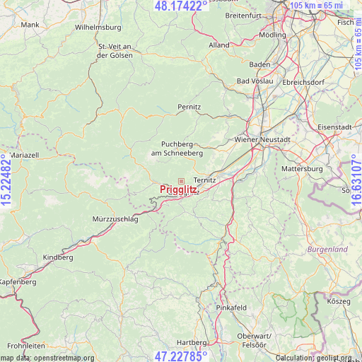
Prigglitz GPS coordinates[2]
47° 42' 11.448" North, 15° 55' 40.584" East
| Map corner | latitude | longitude |
|---|---|---|
| Upper-left | 48.17422°, | 15.22482° |
| Center: | 47.70318°, | 15.92794° |
| Lower-right: | 47.22785°, | 16.63107° |
| Map W x H: | 105.2×105.2 km | = 65.4×65.4mi |
| max Lat: | 48.98333° ⇑46.4% North |
| Prigglitz: | 47.70318° |
| min Lat: | ⇓53.6% South 46.48841° |
| min Long | Prigglitz | max Long |
| 9.57802° | 15.92794° | 17.1° |
| W 78.1%⇐ | ⇒21.9% E |
Elevation
Elevation of Prigglitz is 637 m = 2090 ft, and this is 131.5 m = 431 ft above average elevation for this country.
| Max E: |
2140 m = 7021 ft | 26% |
| Prigglitz | 637 m 2090 ft | |
| Avg. | 505.5 m = 1658 ft | |
Min E: |
118 m = 387 ft | 74% |
See also: Austria elevation on elevation.city.
Geographical zone
Prigglitz is located in North temperate zone (between Tropic of Cancer and the Arctic Circle). Distance of this North polar circle is 2097.1 km =1303.1 mi to North.| Distance of | km | miles | from Prigglitz |
|---|---|---|---|
| North Pole | 4703 | 2922.3 | to North |
| Arctic Circle | 2097.1 | 1303.1 | to North |
| Tropic Cancer | 2698.2 | 1676.6 | to South |
| Equator | 5304.1 | 3295.8 | to South |


Nearby cities:
15 places around Prigglitz: (largest is in red/bold)
• Altendorf
8.9 km =5.5 mi,  131°
131°
• Buchbach
4.3 km =2.7 mi,  100°
100°
• Enzenreith
4.3 km =2.7 mi,  154°
154°
• Gloggnitz
3.3 km =2.1 mi,  165°
165°
• Grafenbach
6.5 km =4 mi,  113°
113°
• Payerbach
5 km =3.1 mi,  255°
255°
• Pottschach
6 km =3.7 mi,  94°
94°
• Putzmannsdorf
5.3 km =3.3 mi, 103°
• Raach am Hochgebirge
7.8 km =4.8 mi,  177°
177°
• Reichenau an der Rax
6.2 km =3.9 mi, 261°
• Sankt Valentin-Landschach
7 km =4.3 mi, 108°
• Schottwien
6.6 km =4.1 mi,  218°
218°
• Stuppach
3.7 km =2.3 mi, 132°
• Ternitz
8.2 km =5.1 mi,  80°
80°
• Wimpassing im Schwarzatale
7.9 km =4.9 mi, 90°
Sources, notices
• [Note1] Compared only with cities in Austria existing in our database
• [Src1] Map data: © OpenStreetMap contributors (CC-BY-SA)
• [Src2] Other city data from geonames.org with taken over terms of usage.
• [Src3] Geographical zone / Annual Mean Temperature by Robert A. Rohde @ Wikipedia
