Pöllau geodata
Pöllau (Styria) is a populated place; located in Austria in Europe/Vienna (GMT+2) time zone. With population of 2,049 people, there are 596 cities with bigger population in this country. Compared to other cities in Austria, 65.5% of cities are located further ↑North; 75.7% of cities are located further ←West and 54.8% of cities have higher elevation than Pöllau. Note1
Administrative division(s):
- Level 1: Styria
- Level 2: Politischer Bezirk Hartberg-Fürstenfeld
- Level 3: Pöllau


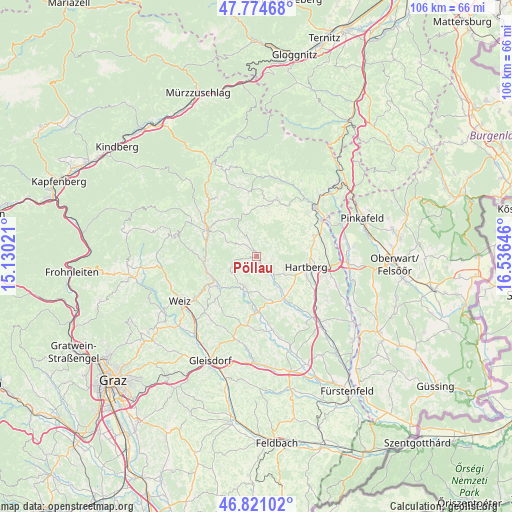
Pöllau GPS coordinates[2]
47° 18' 0" North, 15° 49' 59.988" East
| Map corner | latitude | longitude |
|---|---|---|
| Upper-left | 47.77468°, | 15.13021° |
| Center: | 47.3°, | 15.83333° |
| Lower-right: | 46.82102°, | 16.53646° |
| Map W x H: | 106×106 km | = 65.9×65.9mi |
| max Lat: | 48.98333° ⇑65.5% North |
| Pöllau: | 47.3° |
| min Lat: | ⇓34.5% South 46.48841° |
| min Long | Pöllau | max Long |
| 9.57802° | 15.83333° | 17.1° |
| W 75.7%⇐ | ⇒24.3% E |
Elevation
Elevation of Pöllau is 422 m = 1385 ft, and this is 83.5 m = 274 ft below average elevation for this country.
| Max E: |
2140 m = 7021 ft | 54.8% |
| Avg. | 505.5 m = 1658 ft | |
| Pöllau | 422 m = 1385 ft | |
Min E: |
118 m = 387 ft | 45.2% |
See also: Austria elevation on elevation.city.
Geographical zone
Pöllau is located in North temperate zone (between Tropic of Cancer and the Arctic Circle). Distance of this North polar circle is 2141.9 km =1330.9 mi to North.| Distance of | km | miles | from Pöllau |
|---|---|---|---|
| North Pole | 4747.8 | 2950.1 | to North |
| Arctic Circle | 2141.9 | 1330.9 | to North |
| Tropic Cancer | 2653.3 | 1648.7 | to South |
| Equator | 5259.3 | 3268 | to South |


Nearby cities:
15 places around Pöllau: (largest is in red/bold)
• Dienersdorf
8.4 km =5.2 mi,  142°
142°
• Flattendorf
7.3 km =4.5 mi,  120°
120°
• Floing
7.7 km =4.8 mi,  238°
238°
• Hofkirchen
7.6 km =4.7 mi, 143°
• Löffelbach
7.8 km =4.8 mi,  103°
103°
• Oberneuberg
3.1 km =1.9 mi,  53°
53°
• Obersaifen
4.2 km =2.6 mi,  296°
296°
• Pongrazen bei Hartberg
7.4 km =4.6 mi, 51°
• Prätis
5.3 km =3.3 mi,  342°
342°
• Pöllauberg
2.2 km =1.4 mi,  34°
34°
• Stambach
8.4 km =5.2 mi,  63°
63°
• Stubenberg
6.6 km =4.1 mi,  202°
202°
• Unterneuberg
2.2 km =1.4 mi, 34°
• Zeil
6.7 km =4.2 mi,  214°
214°
• Zeil-Pöllau
2.6 km =1.6 mi,  7°
7°
Sources, notices
• [Note1] Compared only with cities in Austria existing in our database
• [Src1] Map data: © OpenStreetMap contributors (CC-BY-SA)
• [Src2] Other city data from geonames.org with taken over terms of usage.
• [Src3] Geographical zone / Annual Mean Temperature by Robert A. Rohde @ Wikipedia
