Floing geodata
Floing (Styria) is a seat of a third-order administrative division; located in Austria in Europe/Vienna (GMT+2) time zone. With population of 463 people, there are 2547 cities with bigger population in this country. Compared to other cities in Austria, 68.4% of cities are located further ↑North; 73.2% of cities are located further ←West and 78.9% of cities have lower elevation than Floing. Note1


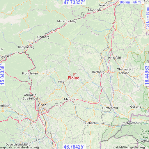
Floing GPS coordinates[2]
47° 15' 48.816" North, 15° 44' 47.4" East
| Map corner | latitude | longitude |
|---|---|---|
| Upper-left | 47.73857°, | 15.04338° |
| Center: | 47.26356°, | 15.7465° |
| Lower-right: | 46.78425°, | 16.44963° |
| Map W x H: | 106.1×106.1 km | = 65.9×65.9mi |
| max Lat: | 48.98333° ⇑68.4% North |
| Floing: | 47.26356° |
| min Lat: | ⇓31.6% South 46.48841° |
| min Long | Floing | max Long |
| 9.57802° | 15.7465° | 17.1° |
| W 73.2%⇐ | ⇒26.8% E |
Elevation
Elevation of Floing is 698 m = 2290 ft, and this is 192.5 m = 632 ft above average elevation for this country.
| Max E: |
2140 m = 7021 ft | 21.1% |
| Floing | 698 m 2290 ft | |
| Avg. | 505.5 m = 1658 ft | |
Min E: |
118 m = 387 ft | 78.9% |
See also: Austria elevation on elevation.city.
Geographical zone
Floing is located in North temperate zone (between Tropic of Cancer and the Arctic Circle). Distance of this North polar circle is 2146 km =1333.5 mi to North.| Distance of | km | miles | from Floing |
|---|---|---|---|
| North Pole | 4751.8 | 2952.6 | to North |
| Arctic Circle | 2146 | 1333.5 | to North |
| Tropic Cancer | 2649.3 | 1646.2 | to South |
| Equator | 5255.2 | 3265.4 | to South |


Nearby cities:
15 places around Floing: (largest is in red/bold)
• Anger
4.3 km =2.7 mi,  285°
285°
• Baierdorf-Umgebung
3.6 km =2.2 mi,  311°
311°
• Etzersdorf
8.5 km =5.3 mi,  214°
214°
• Kaibing
9.6 km =6 mi,  137°
137°
• Oberfeistritz
3.8 km =2.4 mi,  246°
246°
• Obersaifen
6.5 km =4 mi,  25°
25°
• Puch bei Weiz
5.7 km =3.5 mi,  203°
203°
• Pöllau
7.7 km =4.8 mi,  58°
58°
• Reichendorf
8.3 km =5.2 mi,  172°
172°
• Sankt Johann bei Herberstein
8.1 km =5 mi,  150°
150°
• Siegersdorf bei Herberstein
7.6 km =4.7 mi,  158°
158°
• Stubenberg
4.6 km =2.9 mi,  117°
117°
• Unterneuberg
9.8 km =6.1 mi,  52°
52°
• Zeil
3.2 km =2 mi, 118°
• Zeil-Pöllau
9.6 km =6 mi, 45°
Sources, notices
• [Note1] Compared only with cities in Austria existing in our database
• [Src1] Map data: © OpenStreetMap contributors (CC-BY-SA)
• [Src2] Other city data from geonames.org with taken over terms of usage.
• [Src3] Geographical zone / Annual Mean Temperature by Robert A. Rohde @ Wikipedia
