Deutschkreutz geodata
Deutschkreutz (Burgenland) is a seat of a third-order administrative division; located in Austria in Europe/Vienna (GMT+2) time zone. With population of 2,791 people, there are 417 cities with bigger population in this country. Compared to other cities in Austria, 50.4% of cities are located further ↓South; 96.4% of cities are located further ←West and 94.8% of cities have higher elevation than Deutschkreutz. Note1
Administrative division(s):
- Level 1: Burgenland
- Level 2: Politischer Bezirk Oberpullendorf
- Level 3: Deutschkreutz


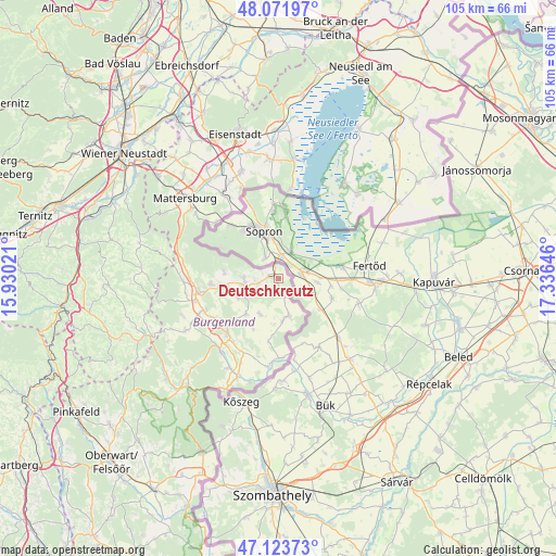
Deutschkreutz GPS coordinates[2]
47° 36' 0" North, 16° 37' 59.988" East
| Map corner | latitude | longitude |
|---|---|---|
| Upper-left | 48.07197°, | 15.93021° |
| Center: | 47.6°, | 16.63333° |
| Lower-right: | 47.12373°, | 17.33646° |
| Map W x H: | 105.4×105.4 km | = 65.5×65.5mi |
| max Lat: | 48.98333° ⇑49.6% North |
| Deutschkreutz: | 47.6° |
| min Lat: | ⇓50.4% South 46.48841° |
| min Long | Deutschkreutz | max Long |
| 9.57802° | 16.63333° | 17.1° |
| W 96.4%⇐ | ⇒3.6% E |
Elevation
Elevation of Deutschkreutz is 180 m = 591 ft, and this is 325.5 m = 1068 ft below average elevation for this country.
| Max E: |
2140 m = 7021 ft | 94.8% |
| Avg. | 505.5 m = 1658 ft | |
| Deutschkreutz | 180 m = 591 ft | |
Min E: |
118 m = 387 ft | 5.2% |
See also: Austria elevation on elevation.city.
Geographical zone
Deutschkreutz is located in North temperate zone (between Tropic of Cancer and the Arctic Circle). Distance of this North polar circle is 2108.6 km =1310.2 mi to North.| Distance of | km | miles | from Deutschkreutz |
|---|---|---|---|
| North Pole | 4714.4 | 2929.4 | to North |
| Arctic Circle | 2108.6 | 1310.2 | to North |
| Tropic Cancer | 2686.7 | 1669.4 | to South |
| Equator | 5292.6 | 3288.7 | to South |


Nearby cities:
15 places around Deutschkreutz: (largest is in red/bold)
• Grosswarasdorf
9.1 km =5.7 mi,  221°
221°
• Horitschon
6.6 km =4.1 mi,  257°
257°
• Lackenbach
12.6 km =7.8 mi,  265°
265°
• Lackendorf
9.8 km =6.1 mi, 263°
• Lutzmannsburg
15.2 km =9.4 mi,  179°
179°
• Mitterpullendorf
14.5 km =9 mi, 215°
• Neckenmarkt
6.5 km =4 mi, 269°
• Neutal
15.3 km =9.5 mi,  246°
246°
• Nikitsch
7.4 km =4.6 mi,  164°
164°
• Oberpullendorf
14.4 km =8.9 mi, 222°
• Raiding
8.6 km =5.3 mi,  243°
243°
• Ritzing
10.4 km =6.5 mi,  278°
278°
• Schattendorf
15.3 km =9.5 mi,  322°
322°
• Stoob
14.1 km =8.8 mi, 235°
• Unterfrauenhaid
10.6 km =6.6 mi, 252°
Sources, notices
• [Note1] Compared only with cities in Austria existing in our database
• [Src1] Map data: © OpenStreetMap contributors (CC-BY-SA)
• [Src2] Other city data from geonames.org with taken over terms of usage.
• [Src3] Geographical zone / Annual Mean Temperature by Robert A. Rohde @ Wikipedia
