Opponitz geodata
Opponitz (Lower Austria) is a seat of a third-order administrative division; located in Austria in Europe/Vienna (GMT+2) time zone. In our database, there are 2958 cities with bigger population. Compared to other cities in Austria, 60.1% of cities are located further ↓South; 51.9% of cities are located further ←West and 55.5% of cities have higher elevation than Opponitz. Note1
Administrative division(s):
- Level 1: Lower Austria
- Level 2: Politischer Bezirk Amstetten
- Level 3: Opponitz


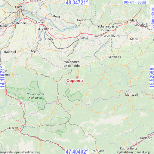
Opponitz GPS coordinates[2]
47° 52' 39.936" North, 14° 49' 22.188" East
| Map corner | latitude | longitude |
|---|---|---|
| Upper-left | 48.34721°, | 14.11971° |
| Center: | 47.87776°, | 14.82283° |
| Lower-right: | 47.40402°, | 15.52596° |
| Map W x H: | 104.9×104.9 km | = 65.2×65.2mi |
| max Lat: | 48.98333° ⇑39.9% North |
| Opponitz: | 47.87776° |
| min Lat: | ⇓60.1% South 46.48841° |
| min Long | Opponitz | max Long |
| 9.57802° | 14.82283° | 17.1° |
| W 51.9%⇐ | ⇒48.1% E |
Elevation
Elevation of Opponitz is 415 m = 1362 ft, and this is 90.5 m = 297 ft below average elevation for this country.
| Max E: |
2140 m = 7021 ft | 55.5% |
| Avg. | 505.5 m = 1658 ft | |
| Opponitz | 415 m = 1362 ft | |
Min E: |
118 m = 387 ft | 44.5% |
See also: Austria elevation on elevation.city.
Geographical zone
Opponitz is located in North temperate zone (between Tropic of Cancer and the Arctic Circle). Distance of this North polar circle is 2077.7 km =1291 mi to North.| Distance of | km | miles | from Opponitz |
|---|---|---|---|
| North Pole | 4683.6 | 2910.3 | to North |
| Arctic Circle | 2077.7 | 1291 | to North |
| Tropic Cancer | 2717.6 | 1688.6 | to South |
| Equator | 5323.5 | 3307.9 | to South |


Nearby cities:
15 places around Opponitz: (largest is in red/bold)
• Böhlerwerk
13.2 km =8.2 mi,  334°
334°
• Gaflenz
7.6 km =4.7 mi,  284°
284°
• Göstling an der Ybbs
11.7 km =7.3 mi,  132°
132°
• Hollenstein an der Ybbs
9.1 km =5.7 mi,  204°
204°
• Konradsheim
11.3 km =7 mi,  315°
315°
• Lunz am See
15.6 km =9.7 mi,  96°
96°
• Sankt Georgen in der Klaus
14.9 km =9.3 mi, 322°
• Sonntagberg
13.9 km =8.6 mi,  340°
340°
• Waidhofen an der Ybbs
9.9 km =6.2 mi, 338°
• Weyer
12.1 km =7.5 mi,  259°
259°
• Windhag
11.4 km =7.1 mi,  352°
352°
• Wirts
7.6 km =4.7 mi, 324°
• Ybbsitz
9.3 km =5.8 mi,  33°
33°
• Zell-Arzberg
8.5 km =5.3 mi, 345°
• Zell-Markt
9.5 km =5.9 mi, 341°
Sources, notices
• [Note1] Compared only with cities in Austria existing in our database
• [Src1] Map data: © OpenStreetMap contributors (CC-BY-SA)
• [Src2] Other city data from geonames.org with taken over terms of usage.
• [Src3] Geographical zone / Annual Mean Temperature by Robert A. Rohde @ Wikipedia
