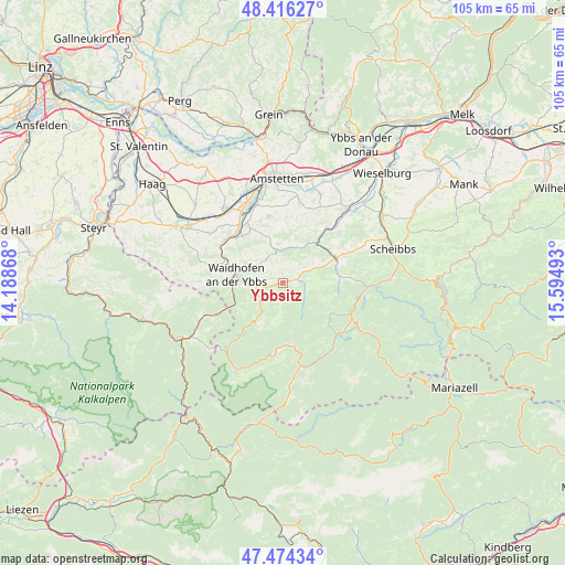
Ybbsitz geodata
Ybbsitz (Lower Austria) is a seat of a third-order administrative division; located in Austria in Europe/Vienna (GMT+2) time zone. With population of 1,721 people, there are 727 cities with bigger population in this country. Compared to other cities in Austria, 62.9% of cities are located further ↓South; 53.1% of cities are located further ←West and 56.1% of cities have higher elevation than Ybbsitz. Note1
Administrative division(s):
- Level 1: Lower Austria
- Level 2: Politischer Bezirk Amstetten
- Level 3: Ybbsitz


Ybbsitz GPS coordinates[2]
47° 56' 50.82" North, 14° 53' 30.48" East
| Map corner | latitude | longitude |
|---|---|---|
| Upper-left | 48.41627°, | 14.18868° |
| Center: | 47.94745°, | 14.8918° |
| Lower-right: | 47.47434°, | 15.59493° |
| Map W x H: | 104.7×104.7 km | = 65.1×65.1mi |
| max Lat: | 48.98333° ⇑37.1% North |
| Ybbsitz: | 47.94745° |
| min Lat: | ⇓62.9% South 46.48841° |
| min Long | Ybbsitz | max Long |
| 9.57802° | 14.8918° | 17.1° |
| W 53.1%⇐ | ⇒46.9% E |
Elevation
Elevation of Ybbsitz is 411 m = 1348 ft, and this is 94.5 m = 310 ft below average elevation for this country.
| Max E: |
2140 m = 7021 ft | 56.1% |
| Avg. | 505.5 m = 1658 ft | |
| Ybbsitz | 411 m = 1348 ft | |
Min E: |
118 m = 387 ft | 43.9% |
See also: Austria elevation on elevation.city.
Geographical zone
Ybbsitz is located in North temperate zone (between Tropic of Cancer and the Arctic Circle). Distance of this North polar circle is 2069.9 km =1286.2 mi to North.| Distance of | km | miles | from Ybbsitz |
|---|---|---|---|
| North Pole | 4675.8 | 2905.4 | to North |
| Arctic Circle | 2069.9 | 1286.2 | to North |
| Tropic Cancer | 2725.3 | 1693.4 | to South |
| Equator | 5331.3 | 3312.7 | to South |


Nearby cities:
15 places around Ybbsitz: (largest is in red/bold)
• Allhartsberg
11.6 km =7.2 mi,  319°
319°
• Böhlerwerk
11.5 km =7.1 mi,  291°
291°
• Gresten
10.8 km =6.7 mi,  67°
67°
• Kematen an der Ybbs
12.8 km =8 mi,  312°
312°
• Konradsheim
13 km =8.1 mi,  271°
271°
• Neuhofen an der Ybbs
12.6 km =7.8 mi,  347°
347°
• Opponitz
9.3 km =5.8 mi,  213°
213°
• Randegg
9.4 km =5.8 mi,  40°
40°
• Sonntagberg
11.1 km =6.9 mi,  298°
298°
• Unteramt
12.3 km =7.6 mi,  62°
62°
• Waidhofen an der Ybbs
8.9 km =5.5 mi,  279°
279°
• Windhag
7.5 km =4.7 mi, 297°
• Wirts
9.7 km =6 mi,  260°
260°
• Zell-Arzberg
7.4 km =4.6 mi, 273°
• Zell-Markt
8.2 km =5.1 mi, 278°
Sources, notices
• [Note1] Compared only with cities in Austria existing in our database
• [Src1] Map data: © OpenStreetMap contributors (CC-BY-SA)
• [Src2] Other city data from geonames.org with taken over terms of usage.
• [Src3] Geographical zone / Annual Mean Temperature by Robert A. Rohde @ Wikipedia
