Ober-Grafendorf geodata
Ober-Grafendorf (Lower Austria) is a seat of a third-order administrative division; located in Austria in Europe/Vienna (GMT+2) time zone. With population of 3,228 people, there are 345 cities with bigger population in this country. Compared to other cities in Austria, 75.7% of cities are located further ↓South; 66.7% of cities are located further ←West and 79% of cities have higher elevation than Ober-Grafendorf. Note1
Administrative division(s):
- Level 1: Lower Austria
- Level 2: Politischer Bezirk Sankt Pölten
- Level 3: Ober-Grafendorf


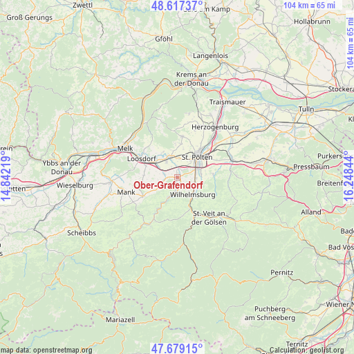
Ober-Grafendorf GPS coordinates[2]
48° 9' 1.44" North, 15° 32' 43.116" East
| Map corner | latitude | longitude |
|---|---|---|
| Upper-left | 48.61737°, | 14.84219° |
| Center: | 48.1504°, | 15.54531° |
| Lower-right: | 47.67915°, | 16.24844° |
| Map W x H: | 104.3×104.3 km | = 64.8×64.8mi |
| max Lat: | 48.98333° ⇑24.3% North |
| Ober-Grafendorf: | 48.1504° |
| min Lat: | ⇓75.7% South 46.48841° |
| min Long | Ober-Grafendorf | max Long |
| 9.57802° | 15.54531° | 17.1° |
| W 66.7%⇐ | ⇒33.3% E |
Elevation
Elevation of Ober-Grafendorf is 279 m = 915 ft, and this is 226.5 m = 743 ft below average elevation for this country.
| Max E: |
2140 m = 7021 ft | 79% |
| Avg. | 505.5 m = 1658 ft | |
| Ober-Grafendorf | 279 m = 915 ft | |
Min E: |
118 m = 387 ft | 21% |
See also: Austria elevation on elevation.city.
Geographical zone
Ober-Grafendorf is located in North temperate zone (between Tropic of Cancer and the Arctic Circle). Distance of this North polar circle is 2047.4 km =1272.2 mi to North.| Distance of | km | miles | from Ober-Grafendorf |
|---|---|---|---|
| North Pole | 4653.2 | 2891.4 | to North |
| Arctic Circle | 2047.4 | 1272.2 | to North |
| Tropic Cancer | 2747.9 | 1707.5 | to South |
| Equator | 5353.8 | 3326.7 | to South |


Nearby cities:
15 places around Ober-Grafendorf: (largest is in red/bold)
• Bischofstetten
6.5 km =4 mi,  241°
241°
• Eggendorf
5.9 km =3.7 mi,  111°
111°
• Gerersdorf
5.7 km =3.5 mi,  8°
8°
• Harland
7 km =4.3 mi,  79°
79°
• Hart
5.2 km =3.2 mi,  86°
86°
• Hofstetten
6.4 km =4 mi,  202°
202°
• Markersdorf an der Pielach
5 km =3.1 mi,  317°
317°
• Mühlgang
5.3 km =3.3 mi,  101°
101°
• Prinzersdorf
5.9 km =3.7 mi,  338°
338°
• Sankt Margarethen an der Sierning
4.2 km =2.6 mi,  283°
283°
• Spratzern
5.9 km =3.7 mi,  67°
67°
• Stattersdorf
7.5 km =4.7 mi,  60°
60°
• Teufelhof
6.4 km =4 mi, 55°
• Weinburg
4.2 km =2.6 mi,  192°
192°
• Wilhelmsburg
6.7 km =4.2 mi,  138°
138°
Sources, notices
• [Note1] Compared only with cities in Austria existing in our database
• [Src1] Map data: © OpenStreetMap contributors (CC-BY-SA)
• [Src2] Other city data from geonames.org with taken over terms of usage.
• [Src3] Geographical zone / Annual Mean Temperature by Robert A. Rohde @ Wikipedia
