Bischofstetten geodata
Bischofstetten (Lower Austria) is a seat of a third-order administrative division; located in Austria in Europe/Vienna (GMT+2) time zone. With population of 644 people, there are 2000 cities with bigger population in this country. Compared to other cities in Austria, 73.9% of cities are located further ↓South; 64.6% of cities are located further ←West and 81.9% of cities have higher elevation than Bischofstetten. Note1
Administrative division(s):
- Level 1: Lower Austria
- Level 2: Politischer Bezirk Melk
- Level 3: Bischofstetten


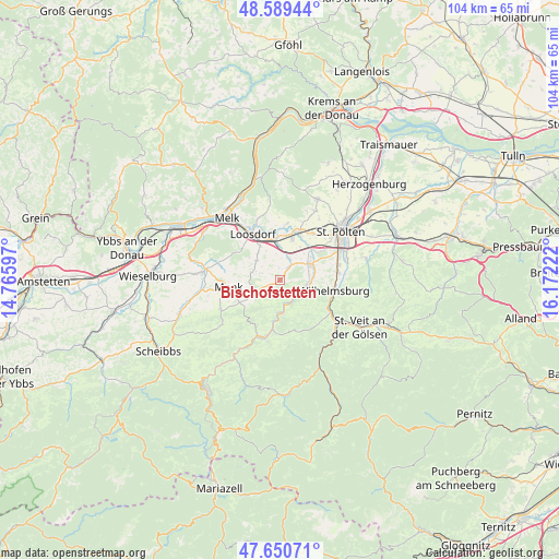
Bischofstetten GPS coordinates[2]
48° 7' 19.992" North, 15° 28' 8.724" East
| Map corner | latitude | longitude |
|---|---|---|
| Upper-left | 48.58944°, | 14.76597° |
| Center: | 48.12222°, | 15.46909° |
| Lower-right: | 47.65071°, | 16.17222° |
| Map W x H: | 104.4×104.4 km | = 64.9×64.9mi |
| max Lat: | 48.98333° ⇑26.1% North |
| Bischofstetten: | 48.12222° |
| min Lat: | ⇓73.9% South 46.48841° |
| min Long | Bischofstetten | max Long |
| 9.57802° | 15.46909° | 17.1° |
| W 64.6%⇐ | ⇒35.4% E |
Elevation
Elevation of Bischofstetten is 265 m = 869 ft, and this is 240.5 m = 789 ft below average elevation for this country.
| Max E: |
2140 m = 7021 ft | 81.9% |
| Avg. | 505.5 m = 1658 ft | |
| Bischofstetten | 265 m = 869 ft | |
Min E: |
118 m = 387 ft | 18.1% |
See also: Austria elevation on elevation.city.
Geographical zone
Bischofstetten is located in North temperate zone (between Tropic of Cancer and the Arctic Circle). Distance of this North polar circle is 2050.5 km =1274.1 mi to North.| Distance of | km | miles | from Bischofstetten |
|---|---|---|---|
| North Pole | 4656.4 | 2893.4 | to North |
| Arctic Circle | 2050.5 | 1274.1 | to North |
| Tropic Cancer | 2744.8 | 1705.5 | to South |
| Equator | 5350.7 | 3324.8 | to South |


Nearby cities:
15 places around Bischofstetten: (largest is in red/bold)
• Dorf Au
6.2 km =3.9 mi,  183°
183°
• Groß Sierning
7.9 km =4.9 mi,  354°
354°
• Haunoldstein
8.8 km =5.5 mi, 350°
• Hofstetten
4.2 km =2.6 mi,  131°
131°
• Hürm
5.6 km =3.5 mi,  311°
311°
• Kilb
5.1 km =3.2 mi,  242°
242°
• Loosdorf
10.1 km =6.3 mi,  329°
329°
• Mank
9.7 km =6 mi,  262°
262°
• Markersdorf an der Pielach
7.2 km =4.5 mi,  18°
18°
• Ober-Grafendorf
6.5 km =4 mi,  61°
61°
• Prinzersdorf
9.3 km =5.8 mi, 22°
• Rabenstein an der Pielach
6.3 km =3.9 mi, 180°
• Sankt Margarethen an der Sierning
4.4 km =2.7 mi, 21°
• Weinburg
4.8 km =3 mi,  101°
101°
• Wilhelmsburg
10.3 km =6.4 mi, 100°
Sources, notices
• [Note1] Compared only with cities in Austria existing in our database
• [Src1] Map data: © OpenStreetMap contributors (CC-BY-SA)
• [Src2] Other city data from geonames.org with taken over terms of usage.
• [Src3] Geographical zone / Annual Mean Temperature by Robert A. Rohde @ Wikipedia
