Nötsch geodata
Nötsch (Carinthia) is a populated place; located in Austria in Europe/Vienna (GMT+2) time zone. With population of 896 people, there are 1440 cities with bigger population in this country. Compared to other cities in Austria, 99% of cities are located further ↑North; 73.2% of cities are located further →East and 64.8% of cities have lower elevation than Nötsch. Note1
Administrative division(s):
- Level 1: Carinthia
- Level 2: Politischer Bezirk Villach Land
- Level 3: Nötsch im Gailtal


Nötsch GPS coordinates[2]
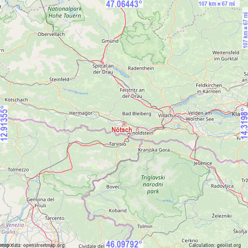
46° 34' 59.988" North, 13° 37' 0.012" East
| Map corner | latitude | longitude |
|---|---|---|
| Upper-left | 47.06443°, | 12.91355° |
| Center: | 46.58333°, | 13.61667° |
| Lower-right: | 46.09792°, | 14.3198° |
| Map W x H: | 107.5×107.5 km | = 66.8×66.8mi |
| max Lat: | 48.98333° ⇑99% North |
| Nötsch: | 46.58333° |
| min Lat: | ⇓1% South 46.48841° |
| min Long | Nötsch | max Long |
| 9.57802° | 13.61667° | 17.1° |
| W 26.8%⇐ | ⇒73.2% E |
Elevation
Elevation of Nötsch is 551 m = 1808 ft, and this is 45.5 m = 149 ft above average elevation for this country.
| Max E: |
2140 m = 7021 ft | 35.2% |
| Nötsch | 551 m 1808 ft | |
| Avg. | 505.5 m = 1658 ft | |
Min E: |
118 m = 387 ft | 64.8% |
See also: Austria elevation on elevation.city.
Geographical zone
Nötsch is located in North temperate zone (between Tropic of Cancer and the Arctic Circle). Distance of this North polar circle is 2221.6 km =1380.4 mi to North.| Distance of | km | miles | from Nötsch |
|---|---|---|---|
| North Pole | 4827.5 | 2999.7 | to North |
| Arctic Circle | 2221.6 | 1380.4 | to North |
| Tropic Cancer | 2573.7 | 1599.2 | to South |
| Equator | 5179.6 | 3218.5 | to South |


Nearby cities:
15 places around Nötsch: (largest is in red/bold)
• Arnoldstein
8.2 km =5.1 mi,  120°
120°
• Bleiberg-Kreuth
5.6 km =3.5 mi,  15°
15°
• Feistritz an der Drau
13.7 km =8.5 mi, 15°
• Feistritz an der Gail
1 km =0.6 mi,  229°
229°
• Gailitz
7.2 km =4.5 mi,  110°
110°
• Hohenthurn
4.4 km =2.7 mi,  130°
130°
• Neu-Feffernitz
12.5 km =7.8 mi, 22°
• Nikelsdorf
13.8 km =8.6 mi,  9°
9°
• Nötsch bei Bleiberg
5.1 km =3.2 mi,  26°
26°
• Paternion
14.6 km =9.1 mi, 5°
• Puch
14.4 km =8.9 mi,  49°
49°
• Pöckau
10.4 km =6.5 mi, 110°
• Riegersdorf
13.1 km =8.1 mi, 106°
• Sankt Georgen
15.1 km =9.4 mi,  68°
68°
• Weissenstein
14.3 km =8.9 mi,  37°
37°
Sources, notices
• [Note1] Compared only with cities in Austria existing in our database
• [Src1] Map data: © OpenStreetMap contributors (CC-BY-SA)
• [Src2] Other city data from geonames.org with taken over terms of usage.
• [Src3] Geographical zone / Annual Mean Temperature by Robert A. Rohde @ Wikipedia
