Hohenthurn geodata
Hohenthurn (Carinthia) is a seat of a third-order administrative division; located in Austria in Europe/Vienna (GMT+2) time zone. With population of 209 people, there are 2843 cities with bigger population in this country. Compared to other cities in Austria, 99.4% of cities are located further ↑North; 72.1% of cities are located further →East and 76.6% of cities have lower elevation than Hohenthurn. Note1
Administrative division(s):
- Level 1: Carinthia
- Level 2: Politischer Bezirk Villach Land
- Level 3: Hohenthurn


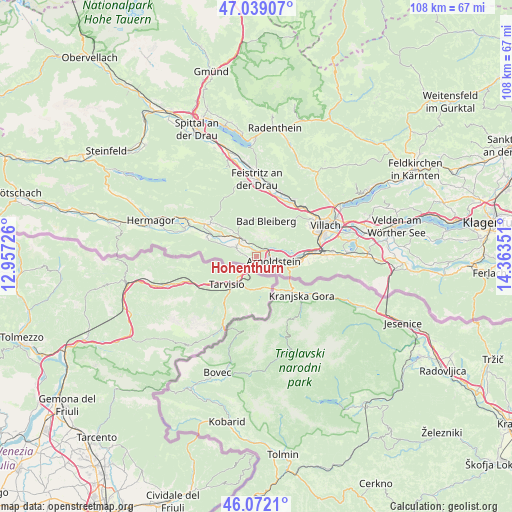
Hohenthurn GPS coordinates[2]
46° 33' 27.864" North, 13° 39' 37.368" East
| Map corner | latitude | longitude |
|---|---|---|
| Upper-left | 47.03907°, | 12.95726° |
| Center: | 46.55774°, | 13.66038° |
| Lower-right: | 46.0721°, | 14.36351° |
| Map W x H: | 107.5×107.5 km | = 66.8×66.8mi |
| max Lat: | 48.98333° ⇑99.4% North |
| Hohenthurn: | 46.55774° |
| min Lat: | ⇓0.6% South 46.48841° |
| min Long | Hohenthurn | max Long |
| 9.57802° | 13.66038° | 17.1° |
| W 27.9%⇐ | ⇒72.1% E |
Elevation
Elevation of Hohenthurn is 670 m = 2198 ft, and this is 164.5 m = 540 ft above average elevation for this country.
| Max E: |
2140 m = 7021 ft | 23.4% |
| Hohenthurn | 670 m 2198 ft | |
| Avg. | 505.5 m = 1658 ft | |
Min E: |
118 m = 387 ft | 76.6% |
See also: Austria elevation on elevation.city.
Geographical zone
Hohenthurn is located in North temperate zone (between Tropic of Cancer and the Arctic Circle). Distance of this North polar circle is 2224.4 km =1382.2 mi to North.| Distance of | km | miles | from Hohenthurn |
|---|---|---|---|
| North Pole | 4830.3 | 3001.4 | to North |
| Arctic Circle | 2224.4 | 1382.2 | to North |
| Tropic Cancer | 2570.8 | 1597.4 | to South |
| Equator | 5176.7 | 3216.7 | to South |


Nearby cities:
15 places around Hohenthurn: (largest is in red/bold)
• Arnoldstein
4 km =2.5 mi,  108°
108°
• Bleiberg-Kreuth
8.5 km =5.3 mi,  347°
347°
• Feistritz an der Gail
4.7 km =2.9 mi,  298°
298°
• Fürnitz
12 km =7.5 mi,  87°
87°
• Gailitz
3.4 km =2.1 mi,  84°
84°
• Goritschach
12.9 km =8 mi,  62°
62°
• Neufellach
13.8 km =8.6 mi, 58°
• Nötsch
4.4 km =2.7 mi,  310°
310°
• Nötsch bei Bleiberg
7.5 km =4.7 mi, 352°
• Obere Fellach
13.8 km =8.6 mi, 55°
• Pöckau
6.4 km =4 mi,  97°
97°
• Riegersdorf
9.3 km =5.8 mi, 95°
• Sankt Georgen
13.6 km =8.5 mi,  51°
51°
• Völkendorf
14.2 km =8.8 mi,  66°
66°
• Warmbad-Judendorf
13.3 km =8.3 mi, 68°
Sources, notices
• [Note1] Compared only with cities in Austria existing in our database
• [Src1] Map data: © OpenStreetMap contributors (CC-BY-SA)
• [Src2] Other city data from geonames.org with taken over terms of usage.
• [Src3] Geographical zone / Annual Mean Temperature by Robert A. Rohde @ Wikipedia
