Pöckau geodata
Pöckau (Carinthia) is a populated place; located in Austria in Europe/Vienna (GMT+2) time zone. With population of 670 people, there are 1932 cities with bigger population in this country. Compared to other cities in Austria, 99.5% of cities are located further ↑North; 70.5% of cities are located further →East and 66.6% of cities have lower elevation than Pöckau. Note1
Administrative division(s):
- Level 1: Carinthia
- Level 2: Politischer Bezirk Villach Land
- Level 3: Arnoldstein


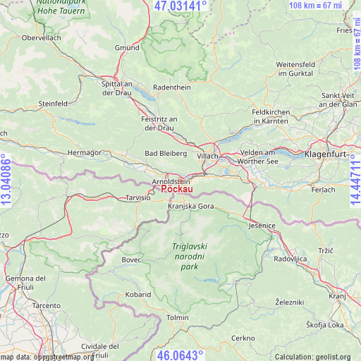
Pöckau GPS coordinates[2]
46° 33' 0.036" North, 13° 44' 38.328" East
| Map corner | latitude | longitude |
|---|---|---|
| Upper-left | 47.03141°, | 13.04086° |
| Center: | 46.55001°, | 13.74398° |
| Lower-right: | 46.0643°, | 14.44711° |
| Map W x H: | 107.5×107.5 km | = 66.8×66.8mi |
| max Lat: | 48.98333° ⇑99.5% North |
| Pöckau: | 46.55001° |
| min Lat: | ⇓0.5% South 46.48841° |
| min Long | Pöckau | max Long |
| 9.57802° | 13.74398° | 17.1° |
| W 29.5%⇐ | ⇒70.5% E |
Elevation
Elevation of Pöckau is 563 m = 1847 ft, and this is 57.5 m = 189 ft above average elevation for this country.
| Max E: |
2140 m = 7021 ft | 33.4% |
| Pöckau | 563 m 1847 ft | |
| Avg. | 505.5 m = 1658 ft | |
Min E: |
118 m = 387 ft | 66.6% |
See also: Austria elevation on elevation.city.
Geographical zone
Pöckau is located in North temperate zone (between Tropic of Cancer and the Arctic Circle). Distance of this North polar circle is 2225.3 km =1382.7 mi to North.| Distance of | km | miles | from Pöckau |
|---|---|---|---|
| North Pole | 4831.2 | 3002 | to North |
| Arctic Circle | 2225.3 | 1382.7 | to North |
| Tropic Cancer | 2570 | 1596.9 | to South |
| Equator | 5175.9 | 3216.2 | to South |


Nearby cities:
15 places around Pöckau: (largest is in red/bold)
• Arnoldstein
2.6 km =1.6 mi,  260°
260°
• Auen
9.4 km =5.8 mi,  54°
54°
• Finkenstein
9.8 km =6.1 mi,  82°
82°
• Fürnitz
5.8 km =3.6 mi, 76°
• Gailitz
3.3 km =2.1 mi,  291°
291°
• Goritschach
8.5 km =5.3 mi,  35°
35°
• Hohenthurn
6.4 km =4 mi,  277°
277°
• Illitsch
9.5 km =5.9 mi,  97°
97°
• Neufellach
9.7 km =6 mi,  34°
34°
• Obere Fellach
10.1 km =6.3 mi, 29°
• Riegersdorf
2.8 km =1.7 mi,  90°
90°
• Sankt Georgen
10.2 km =6.3 mi,  24°
24°
• Sankt Martin
9.9 km =6.2 mi, 40°
• Völkendorf
9.3 km =5.8 mi, 46°
• Warmbad-Judendorf
8.3 km =5.2 mi, 46°
Sources, notices
• [Note1] Compared only with cities in Austria existing in our database
• [Src1] Map data: © OpenStreetMap contributors (CC-BY-SA)
• [Src2] Other city data from geonames.org with taken over terms of usage.
• [Src3] Geographical zone / Annual Mean Temperature by Robert A. Rohde @ Wikipedia
