Dorfheim geodata
Dorfheim (Salzburg) is a populated place; located in Austria in Europe/Vienna (GMT+2) time zone. With population of 733 people, there are 1767 cities with bigger population in this country. Compared to other cities in Austria, 57.4% of cities are located further ↑North; 84.3% of cities are located further →East and 81.5% of cities have lower elevation than Dorfheim. Note1
Administrative division(s):
- Level 1: Salzburg
- Level 2: Politischer Bezirk Zell am See
- Level 3: Saalfelden am Steinernen Meer


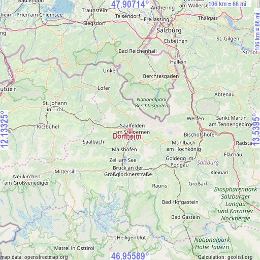
Dorfheim GPS coordinates[2]
47° 26' 1.176" North, 12° 50' 10.932" East
| Map corner | latitude | longitude |
|---|---|---|
| Upper-left | 47.90714°, | 12.13325° |
| Center: | 47.43366°, | 12.83637° |
| Lower-right: | 46.95589°, | 13.5395° |
| Map W x H: | 105.8×105.8 km | = 65.7×65.7mi |
| max Lat: | 48.98333° ⇑57.4% North |
| Dorfheim: | 47.43366° |
| min Lat: | ⇓42.6% South 46.48841° |
| min Long | Dorfheim | max Long |
| 9.57802° | 12.83637° | 17.1° |
| W 15.7%⇐ | ⇒84.3% E |
Elevation
Elevation of Dorfheim is 743 m = 2438 ft, and this is 237.5 m = 779 ft above average elevation for this country.
| Max E: |
2140 m = 7021 ft | 18.5% |
| Dorfheim | 743 m 2438 ft | |
| Avg. | 505.5 m = 1658 ft | |
Min E: |
118 m = 387 ft | 81.5% |
See also: Austria elevation on elevation.city.
Geographical zone
Dorfheim is located in North temperate zone (between Tropic of Cancer and the Arctic Circle). Distance of this North polar circle is 2127 km =1321.7 mi to North.| Distance of | km | miles | from Dorfheim |
|---|---|---|---|
| North Pole | 4732.9 | 2940.9 | to North |
| Arctic Circle | 2127 | 1321.7 | to North |
| Tropic Cancer | 2668.2 | 1657.9 | to South |
| Equator | 5274.1 | 3277.2 | to South |


Nearby cities:
15 places around Dorfheim: (largest is in red/bold)
• Atzing
8.9 km =5.5 mi,  197°
197°
• Bsuch
3.6 km =2.2 mi,  177°
177°
• Haid
3 km =1.9 mi, 204°
• Lenzing
2.2 km =1.4 mi,  314°
314°
• Leogang
5.7 km =3.5 mi,  276°
276°
• Maishofen
7.9 km =4.9 mi, 200°
• Maria Alm am Steinernen Meer
5.8 km =3.6 mi,  122°
122°
• Mitterhofen
6.2 km =3.9 mi,  206°
206°
• Ramseiden
2.8 km =1.7 mi,  114°
114°
• Saalfelden am Steinernen Meer
1.2 km =0.7 mi,  131°
131°
• Sonnberg
8 km =5 mi, 283°
• Thor
1.4 km =0.9 mi,  158°
158°
• Thumersbach
11.7 km =7.3 mi,  187°
187°
• Viehhofen
10.8 km =6.7 mi,  226°
226°
• Zell am See
12.4 km =7.7 mi, 194°
Sources, notices
• [Note1] Compared only with cities in Austria existing in our database
• [Src1] Map data: © OpenStreetMap contributors (CC-BY-SA)
• [Src2] Other city data from geonames.org with taken over terms of usage.
• [Src3] Geographical zone / Annual Mean Temperature by Robert A. Rohde @ Wikipedia
