Leogang geodata
Leogang (Salzburg) is a seat of a third-order administrative division; located in Austria in Europe/Vienna (GMT+2) time zone. With population of 377 people, there are 2650 cities with bigger population in this country. Compared to other cities in Austria, 57.4% of cities are located further ↑North; 85% of cities are located further →East and 84.2% of cities have lower elevation than Leogang. Note1
Administrative division(s):
- Level 1: Salzburg
- Level 2: Politischer Bezirk Zell am See
- Level 3: Leogang


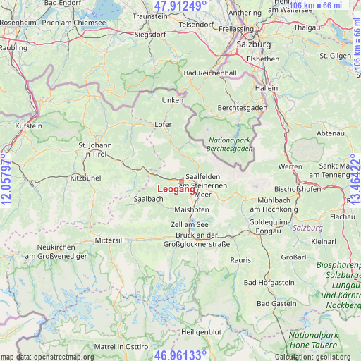
Leogang GPS coordinates[2]
47° 26' 20.616" North, 12° 45' 39.924" East
| Map corner | latitude | longitude |
|---|---|---|
| Upper-left | 47.91249°, | 12.05797° |
| Center: | 47.43906°, | 12.76109° |
| Lower-right: | 46.96133°, | 13.46422° |
| Map W x H: | 105.8×105.8 km | = 65.7×65.7mi |
| max Lat: | 48.98333° ⇑57.4% North |
| Leogang: | 47.43906° |
| min Lat: | ⇓42.6% South 46.48841° |
| min Long | Leogang | max Long |
| 9.57802° | 12.76109° | 17.1° |
| W 15%⇐ | ⇒85% E |
Elevation
Elevation of Leogang is 785 m = 2575 ft, and this is 279.5 m = 917 ft above average elevation for this country.
| Max E: |
2140 m = 7021 ft | 15.8% |
| Leogang | 785 m 2575 ft | |
| Avg. | 505.5 m = 1658 ft | |
Min E: |
118 m = 387 ft | 84.2% |
See also: Austria elevation on elevation.city.
Geographical zone
Leogang is located in North temperate zone (between Tropic of Cancer and the Arctic Circle). Distance of this North polar circle is 2126.4 km =1321.3 mi to North.| Distance of | km | miles | from Leogang |
|---|---|---|---|
| North Pole | 4732.3 | 2940.5 | to North |
| Arctic Circle | 2126.4 | 1321.3 | to North |
| Tropic Cancer | 2668.8 | 1658.3 | to South |
| Equator | 5274.7 | 3277.5 | to South |


Nearby cities:
15 places around Leogang: (largest is in red/bold)
• Atzing
9.5 km =5.9 mi,  162°
162°
• Bsuch
7.2 km =4.5 mi,  125°
125°
• Dorfheim
5.7 km =3.5 mi,  96°
96°
• Haid
5.6 km =3.5 mi, 127°
• Hochfilzen
11.3 km =7 mi,  285°
285°
• Lenzing
4.2 km =2.6 mi,  77°
77°
• Maishofen
8.6 km =5.3 mi, 160°
• Maria Alm am Steinernen Meer
11.2 km =7 mi,  109°
109°
• Mitterhofen
6.9 km =4.3 mi,  154°
154°
• Ramseiden
8.4 km =5.2 mi, 101°
• Saalbach
10.8 km =6.7 mi,  240°
240°
• Saalfelden am Steinernen Meer
6.7 km =4.2 mi, 101°
• Sonnberg
2.4 km =1.5 mi,  300°
300°
• Thor
6.5 km =4 mi, 107°
• Viehhofen
8.3 km =5.2 mi,  194°
194°
Sources, notices
• [Note1] Compared only with cities in Austria existing in our database
• [Src1] Map data: © OpenStreetMap contributors (CC-BY-SA)
• [Src2] Other city data from geonames.org with taken over terms of usage.
• [Src3] Geographical zone / Annual Mean Temperature by Robert A. Rohde @ Wikipedia
