Paudorf geodata
Paudorf (Lower Austria) is a seat of a third-order administrative division; located in Austria in Europe/Vienna (GMT+2) time zone. With population of 895 people, there are 1442 cities with bigger population in this country. Compared to other cities in Austria, 88.7% of cities are located further ↓South; 69.6% of cities are located further ←West and 82.7% of cities have higher elevation than Paudorf. Note1
Administrative division(s):
- Level 1: Lower Austria
- Level 2: Politischer Bezirk Krems
- Level 3: Paudorf


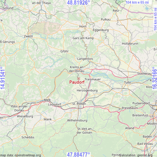
Paudorf GPS coordinates[2]
48° 21' 14.976" North, 15° 37' 6.708" East
| Map corner | latitude | longitude |
|---|---|---|
| Upper-left | 48.81926°, | 14.91541° |
| Center: | 48.35416°, | 15.61853° |
| Lower-right: | 47.88477°, | 16.32166° |
| Map W x H: | 103.9×103.9 km | = 64.6×64.6mi |
| max Lat: | 48.98333° ⇑11.3% North |
| Paudorf: | 48.35416° |
| min Lat: | ⇓88.7% South 46.48841° |
| min Long | Paudorf | max Long |
| 9.57802° | 15.61853° | 17.1° |
| W 69.6%⇐ | ⇒30.4% E |
Elevation
Elevation of Paudorf is 261 m = 856 ft, and this is 244.5 m = 802 ft below average elevation for this country.
| Max E: |
2140 m = 7021 ft | 82.7% |
| Avg. | 505.5 m = 1658 ft | |
| Paudorf | 261 m = 856 ft | |
Min E: |
118 m = 387 ft | 17.3% |
See also: Austria elevation on elevation.city.
Geographical zone
Paudorf is located in North temperate zone (between Tropic of Cancer and the Arctic Circle). Distance of this North polar circle is 2024.7 km =1258.1 mi to North.| Distance of | km | miles | from Paudorf |
|---|---|---|---|
| North Pole | 4630.6 | 2877.3 | to North |
| Arctic Circle | 2024.7 | 1258.1 | to North |
| Tropic Cancer | 2770.6 | 1721.6 | to South |
| Equator | 5376.5 | 3340.8 | to South |


Nearby cities:
15 places around Paudorf: (largest is in red/bold)
• Furth bei Göttweig
2.2 km =1.4 mi,  351°
351°
• Getzersdorf
6.4 km =4 mi,  116°
116°
• Inzersdorf ob der Traisen
5.4 km =3.4 mi,  142°
142°
• Krems an der Donau
6.1 km =3.8 mi,  356°
356°
• Landersdorf
7 km =4.3 mi,  8°
8°
• Lerchenfeld
6.5 km =4 mi, 8°
• Mautern
5.3 km =3.3 mi,  325°
325°
• Nussdorf ob der Traisen
5.7 km =3.5 mi,  91°
91°
• Oberwölbling
4.6 km =2.9 mi,  205°
205°
• Palt
3.4 km =2.1 mi, 354°
• Reichersdorf
6.2 km =3.9 mi,  107°
107°
• Statzendorf
5.5 km =3.4 mi,  162°
162°
• Stein an der Donau
6 km =3.7 mi, 332°
• Unterbergern
5.3 km =3.3 mi,  285°
285°
• Weinzierl bei Krems
5.3 km =3.3 mi,  344°
344°
Sources, notices
• [Note1] Compared only with cities in Austria existing in our database
• [Src1] Map data: © OpenStreetMap contributors (CC-BY-SA)
• [Src2] Other city data from geonames.org with taken over terms of usage.
• [Src3] Geographical zone / Annual Mean Temperature by Robert A. Rohde @ Wikipedia
