Schiltern geodata
Schiltern (Lower Austria) is a populated place; located in Austria in Europe/Vienna (GMT+2) time zone. With population of 653 people, there are 1976 cities with bigger population in this country. Compared to other cities in Austria, 94.6% of cities are located further ↓South; 69.2% of cities are located further ←West and 57.7% of cities have higher elevation than Schiltern. Note1
Administrative division(s):
- Level 1: Lower Austria
- Level 2: Politischer Bezirk Krems
- Level 3: Langenlois


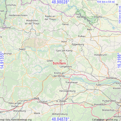
Schiltern GPS coordinates[2]
48° 31' 0.012" North, 15° 37' 0.012" East
| Map corner | latitude | longitude |
|---|---|---|
| Upper-left | 48.98028°, | 14.91355° |
| Center: | 48.51667°, | 15.61667° |
| Lower-right: | 48.04878°, | 16.3198° |
| Map W x H: | 103.6×103.6 km | = 64.4×64.4mi |
| max Lat: | 48.98333° ⇑5.4% North |
| Schiltern: | 48.51667° |
| min Lat: | ⇓94.6% South 46.48841° |
| min Long | Schiltern | max Long |
| 9.57802° | 15.61667° | 17.1° |
| W 69.2%⇐ | ⇒30.8% E |
Elevation
Elevation of Schiltern is 400 m = 1312 ft, and this is 105.5 m = 346 ft below average elevation for this country.
| Max E: |
2140 m = 7021 ft | 57.7% |
| Avg. | 505.5 m = 1658 ft | |
| Schiltern | 400 m = 1312 ft | |
Min E: |
118 m = 387 ft | 42.3% |
See also: Austria elevation on elevation.city.
Geographical zone
Schiltern is located in North temperate zone (between Tropic of Cancer and the Arctic Circle). Distance of this North polar circle is 2006.6 km =1246.8 mi to North.| Distance of | km | miles | from Schiltern |
|---|---|---|---|
| North Pole | 4612.5 | 2866.1 | to North |
| Arctic Circle | 2006.6 | 1246.8 | to North |
| Tropic Cancer | 2788.6 | 1732.8 | to South |
| Equator | 5394.5 | 3352 | to South |


Nearby cities:
15 places around Schiltern: (largest is in red/bold)
• Droß
6.6 km =4.1 mi,  207°
207°
• Gars am Kamp
8.5 km =5.3 mi,  18°
18°
• Gföhl
9.8 km =6.1 mi,  270°
270°
• Gneixendorf
8.8 km =5.5 mi,  179°
179°
• Gobelsburg
8.8 km =5.5 mi,  135°
135°
• Imbach
7.8 km =4.8 mi,  198°
198°
• Jaidhof
10 km =6.2 mi,  280°
280°
• Langenlois
6.7 km =4.2 mi,  146°
146°
• Lengenfeld
5.2 km =3.2 mi,  194°
194°
• Rehberg
9.8 km =6.1 mi, 192°
• Schönberg
6.1 km =3.8 mi,  90°
90°
• Strass
10.2 km =6.3 mi,  122°
122°
• Stratzing
7.5 km =4.7 mi, 189°
• Wolfshoferamt
10 km =6.2 mi,  338°
338°
• Zöbing
6.2 km =3.9 mi,  127°
127°
Sources, notices
• [Note1] Compared only with cities in Austria existing in our database
• [Src1] Map data: © OpenStreetMap contributors (CC-BY-SA)
• [Src2] Other city data from geonames.org with taken over terms of usage.
• [Src3] Geographical zone / Annual Mean Temperature by Robert A. Rohde @ Wikipedia
