Leithaprodersdorf geodata
Leithaprodersdorf (Burgenland) is a seat of a third-order administrative division; located in Austria in Europe/Vienna (GMT+2) time zone. With population of 1,193 people, there are 1053 cities with bigger population in this country. Compared to other cities in Austria, 62.4% of cities are located further ↓South; 93.3% of cities are located further ←West and 92.8% of cities have higher elevation than Leithaprodersdorf. Note1
Administrative division(s):
- Level 1: Burgenland
- Level 2: Eisenstadt-Umgebung
- Level 3: Leithaprodersdorf


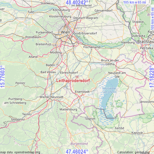
Leithaprodersdorf GPS coordinates[2]
47° 56' 0.528" North, 16° 28' 44.94" East
| Map corner | latitude | longitude |
|---|---|---|
| Upper-left | 48.40242°, | 15.77603° |
| Center: | 47.93348°, | 16.47915° |
| Lower-right: | 47.46024°, | 17.18228° |
| Map W x H: | 104.8×104.8 km | = 65.1×65.1mi |
| max Lat: | 48.98333° ⇑37.6% North |
| Leithaprodersdorf: | 47.93348° |
| min Lat: | ⇓62.4% South 46.48841° |
| min Long | Leithaprodersdo | max Long |
| 9.57802° | 16.47915° | 17.1° |
| W 93.3%⇐ | ⇒6.7% E |
Elevation
Elevation of Leithaprodersdorf is 194 m = 636 ft, and this is 311.5 m = 1022 ft below average elevation for this country.
| Max E: |
2140 m = 7021 ft | 92.8% |
| Avg. | 505.5 m = 1658 ft | |
| Leithaprodersdorf | 194 m = 636 ft | |
Min E: |
118 m = 387 ft | 7.2% |
See also: Austria elevation on elevation.city.
Geographical zone
Leithaprodersdorf is located in North temperate zone (between Tropic of Cancer and the Arctic Circle). Distance of this North polar circle is 2071.5 km =1287.2 mi to North.| Distance of | km | miles | from Leithaprodersdorf |
|---|---|---|---|
| North Pole | 4677.4 | 2906.4 | to North |
| Arctic Circle | 2071.5 | 1287.2 | to North |
| Tropic Cancer | 2723.8 | 1692.5 | to South |
| Equator | 5329.7 | 3311.7 | to South |


Nearby cities:
15 places around Leithaprodersdorf: (largest is in red/bold)
• Au am Leithaberge
6 km =3.7 mi,  101°
101°
• Deutschbrodersdorf
1.3 km =0.8 mi,  324°
324°
• Ebreichsdorf
5.9 km =3.7 mi,  294°
294°
• Hof am Leithaberge
8 km =5 mi,  76°
76°
• Hornstein
6.4 km =4 mi,  203°
203°
• Landegg
7 km =4.3 mi,  237°
237°
• Loretto
3.5 km =2.2 mi,  124°
124°
• Mitterndorf an der Fischa
7.1 km =4.4 mi,  356°
356°
• Reisenberg
7.4 km =4.6 mi,  24°
24°
• Seibersdorf
4 km =2.5 mi,  46°
46°
• Stotzing
5.8 km =3.6 mi, 120°
• Unterwaltersdorf
5 km =3.1 mi, 291°
• Wampersdorf
5 km =3.1 mi,  248°
248°
• Weigelsdorf
6.2 km =3.9 mi, 287°
• Wimpassing an der Leitha
3.9 km =2.4 mi, 241°
Sources, notices
• [Note1] Compared only with cities in Austria existing in our database
• [Src1] Map data: © OpenStreetMap contributors (CC-BY-SA)
• [Src2] Other city data from geonames.org with taken over terms of usage.
• [Src3] Geographical zone / Annual Mean Temperature by Robert A. Rohde @ Wikipedia
