Weigelsdorf geodata
Weigelsdorf (Lower Austria) is a populated place; located in Austria in Europe/Vienna (GMT+2) time zone. With population of 2,680 people, there are 438 cities with bigger population in this country. Compared to other cities in Austria, 63.1% of cities are located further ↓South; 91.2% of cities are located further ←West and 91.8% of cities have higher elevation than Weigelsdorf. Note1
Administrative division(s):
- Level 1: Lower Austria
- Level 2: Politischer Bezirk Baden
- Level 3: Ebreichsdorf


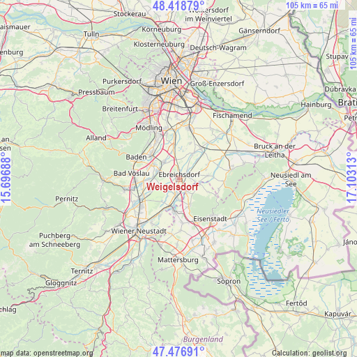
Weigelsdorf GPS coordinates[2]
47° 57' 0" North, 16° 24' 0" East
| Map corner | latitude | longitude |
|---|---|---|
| Upper-left | 48.41879°, | 15.69688° |
| Center: | 47.95°, | 16.4° |
| Lower-right: | 47.47691°, | 17.10313° |
| Map W x H: | 104.7×104.7 km | = 65.1×65.1mi |
| max Lat: | 48.98333° ⇑36.9% North |
| Weigelsdorf: | 47.95° |
| min Lat: | ⇓63.1% South 46.48841° |
| min Long | Weigelsdorf | max Long |
| 9.57802° | 16.4° | 17.1° |
| W 91.2%⇐ | ⇒8.8% E |
Elevation
Elevation of Weigelsdorf is 202 m = 663 ft, and this is 303.5 m = 996 ft below average elevation for this country.
| Max E: |
2140 m = 7021 ft | 91.8% |
| Avg. | 505.5 m = 1658 ft | |
| Weigelsdorf | 202 m = 663 ft | |
Min E: |
118 m = 387 ft | 8.2% |
See also: Austria elevation on elevation.city.
Geographical zone
Weigelsdorf is located in North temperate zone (between Tropic of Cancer and the Arctic Circle). Distance of this North polar circle is 2069.6 km =1286 mi to North.| Distance of | km | miles | from Weigelsdorf |
|---|---|---|---|
| North Pole | 4675.5 | 2905.2 | to North |
| Arctic Circle | 2069.6 | 1286 | to North |
| Tropic Cancer | 2725.6 | 1693.6 | to South |
| Equator | 5331.5 | 3312.8 | to South |


Nearby cities:
15 places around Weigelsdorf: (largest is in red/bold)
• Deutschbrodersdorf
5.2 km =3.2 mi,  98°
98°
• Ebreichsdorf
0.8 km =0.5 mi,  39°
39°
• Haschendorf
8.1 km =5 mi,  211°
211°
• Landegg
5.6 km =3.5 mi,  180°
180°
• Leithaprodersdorf
6.2 km =3.9 mi,  107°
107°
• Mitterndorf an der Fischa
7.6 km =4.7 mi,  46°
46°
• Moosbrunn
8.3 km =5.2 mi,  26°
26°
• Oberwaltersdorf
6.5 km =4 mi,  296°
296°
• Pottendorf
5.7 km =3.5 mi,  192°
192°
• Siegersdorf
6.7 km =4.2 mi, 213°
• Tattendorf
7.4 km =4.6 mi,  270°
270°
• Trumau
6.4 km =4 mi,  318°
318°
• Unterwaltersdorf
1.2 km =0.7 mi,  90°
90°
• Wampersdorf
3.9 km =2.4 mi,  161°
161°
• Wimpassing an der Leitha
4.5 km =2.8 mi,  146°
146°
Sources, notices
• [Note1] Compared only with cities in Austria existing in our database
• [Src1] Map data: © OpenStreetMap contributors (CC-BY-SA)
• [Src2] Other city data from geonames.org with taken over terms of usage.
• [Src3] Geographical zone / Annual Mean Temperature by Robert A. Rohde @ Wikipedia
