Ebreichsdorf geodata
Ebreichsdorf (Lower Austria) is a seat of a third-order administrative division; located in Austria in Europe/Vienna (GMT+2) time zone. With population of 5,236 people, there are 184 cities with bigger population in this country. Compared to other cities in Austria, 63.8% of cities are located further ↓South; 91.5% of cities are located further ←West and 92.2% of cities have higher elevation than Ebreichsdorf. Note1
Administrative division(s):
- Level 1: Lower Austria
- Level 2: Politischer Bezirk Baden
- Level 3: Ebreichsdorf


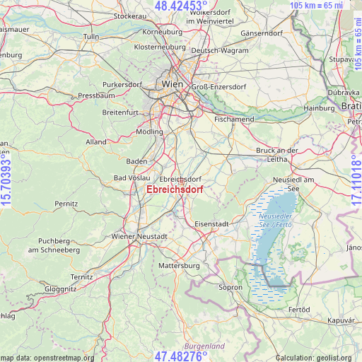
Ebreichsdorf GPS coordinates[2]
47° 57' 20.844" North, 16° 24' 25.38" East
| Map corner | latitude | longitude |
|---|---|---|
| Upper-left | 48.42453°, | 15.70393° |
| Center: | 47.95579°, | 16.40705° |
| Lower-right: | 47.48276°, | 17.11018° |
| Map W x H: | 104.7×104.7 km | = 65.1×65.1mi |
| max Lat: | 48.98333° ⇑36.2% North |
| Ebreichsdorf: | 47.95579° |
| min Lat: | ⇓63.8% South 46.48841° |
| min Long | Ebreichsdorf | max Long |
| 9.57802° | 16.40705° | 17.1° |
| W 91.5%⇐ | ⇒8.5% E |
Elevation
Elevation of Ebreichsdorf is 199 m = 653 ft, and this is 306.5 m = 1006 ft below average elevation for this country.
| Max E: |
2140 m = 7021 ft | 92.2% |
| Avg. | 505.5 m = 1658 ft | |
| Ebreichsdorf | 199 m = 653 ft | |
Min E: |
118 m = 387 ft | 7.8% |
See also: Austria elevation on elevation.city.
Geographical zone
Ebreichsdorf is located in North temperate zone (between Tropic of Cancer and the Arctic Circle). Distance of this North polar circle is 2069 km =1285.6 mi to North.| Distance of | km | miles | from Ebreichsdorf |
|---|---|---|---|
| North Pole | 4674.9 | 2904.8 | to North |
| Arctic Circle | 2069 | 1285.6 | to North |
| Tropic Cancer | 2726.3 | 1694 | to South |
| Equator | 5332.2 | 3313.3 | to South |


Nearby cities:
15 places around Ebreichsdorf: (largest is in red/bold)
• Deutschbrodersdorf
4.9 km =3 mi,  107°
107°
• Landegg
6.2 km =3.9 mi,  184°
184°
• Leithaprodersdorf
5.9 km =3.7 mi, 114°
• Mitterndorf an der Fischa
6.8 km =4.2 mi,  46°
46°
• Moosbrunn
7.5 km =4.7 mi,  25°
25°
• Oberwaltersdorf
6.7 km =4.2 mi,  289°
289°
• Pottendorf
6.5 km =4 mi,  195°
195°
• Seibersdorf
8.3 km =5.2 mi,  87°
87°
• Siegersdorf
7.5 km =4.7 mi,  214°
214°
• Tattendorf
8 km =5 mi,  265°
265°
• Trumau
6.4 km =4 mi,  311°
311°
• Unterwaltersdorf
1 km =0.6 mi,  131°
131°
• Wampersdorf
4.4 km =2.7 mi,  170°
170°
• Weigelsdorf
0.8 km =0.5 mi,  219°
219°
• Wimpassing an der Leitha
4.8 km =3 mi,  155°
155°
Sources, notices
• [Note1] Compared only with cities in Austria existing in our database
• [Src1] Map data: © OpenStreetMap contributors (CC-BY-SA)
• [Src2] Other city data from geonames.org with taken over terms of usage.
• [Src3] Geographical zone / Annual Mean Temperature by Robert A. Rohde @ Wikipedia
