Laa an der Thaya geodata
Laa an der Thaya (Lower Austria) is a seat of a third-order administrative division; located in Austria in Europe/Vienna (GMT+2) time zone. With population of 4,777 people, there are 202 cities with bigger population in this country. Compared to other cities in Austria, 98.4% of cities are located further ↓South; 90.8% of cities are located further ←West and 95.1% of cities have higher elevation than Laa an der Thaya. Note1
Administrative division(s):
- Level 1: Lower Austria
- Level 2: Politischer Bezirk Mistelbach
- Level 3: Laa an der Thaya


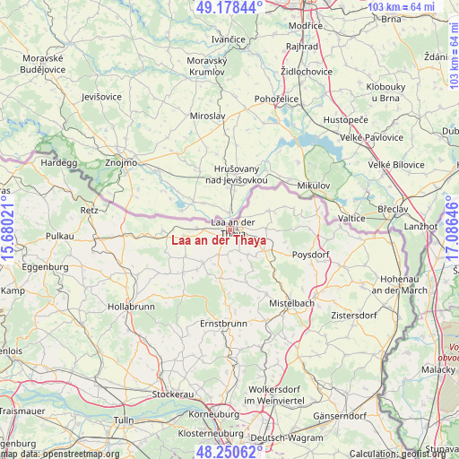
Laa an der Thaya GPS coordinates[2]
48° 43' 0.012" North, 16° 22' 59.988" East
| Map corner | latitude | longitude |
|---|---|---|
| Upper-left | 49.17844°, | 15.68021° |
| Center: | 48.71667°, | 16.38333° |
| Lower-right: | 48.25062°, | 17.08646° |
| Map W x H: | 103.2×103.2 km | = 64.1×64.1mi |
| max Lat: | 48.98333° ⇑1.6% North |
| Laa an der Thaya: | 48.71667° |
| min Lat: | ⇓98.4% South 46.48841° |
| min Long | Laa an der Thay | max Long |
| 9.57802° | 16.38333° | 17.1° |
| W 90.8%⇐ | ⇒9.2% E |
Elevation
Elevation of Laa an der Thaya is 179 m = 587 ft, and this is 326.5 m = 1071 ft below average elevation for this country.
| Max E: |
2140 m = 7021 ft | 95.1% |
| Avg. | 505.5 m = 1658 ft | |
| Laa an der Thaya | 179 m = 587 ft | |
Min E: |
118 m = 387 ft | 4.9% |
See also: Austria elevation on elevation.city.
Geographical zone
Laa an der Thaya is located in North temperate zone (between Tropic of Cancer and the Arctic Circle). Distance of this North polar circle is 1984.4 km =1233 mi to North.| Distance of | km | miles | from Laa an der Thaya |
|---|---|---|---|
| North Pole | 4590.3 | 2852.3 | to North |
| Arctic Circle | 1984.4 | 1233 | to North |
| Tropic Cancer | 2810.9 | 1746.6 | to South |
| Equator | 5416.8 | 3365.8 | to South |


Nearby cities:
15 places around Laa an der Thaya: (largest is in red/bold)
• Falkenstein
14.7 km =9.1 mi,  90°
90°
• Fallbach
7.8 km =4.8 mi,  161°
161°
• Gaubitsch
7.4 km =4.6 mi,  180°
180°
• Gnadendorf
11.2 km =7 mi,  173°
173°
• Großharras
11.7 km =7.3 mi,  239°
239°
• Großkadolz
14.5 km =9 mi,  268°
268°
• Hanfthal
2.2 km =1.4 mi,  213°
213°
• Kautendorf
9.2 km =5.7 mi,  127°
127°
• Neudorf bei Staatz
7.9 km =4.9 mi, 86°
• Ottenthal
15.2 km =9.4 mi,  71°
71°
• Staatz
8.9 km =5.5 mi,  120°
120°
• Stronsdorf
9.5 km =5.9 mi,  220°
220°
• Unterstinkenbrunn
6.1 km =3.8 mi, 206°
• Wildendürnbach
9.8 km =6.1 mi,  63°
63°
• Wulzeshofen
6.1 km =3.8 mi, 270°
Sources, notices
• [Note1] Compared only with cities in Austria existing in our database
• [Src1] Map data: © OpenStreetMap contributors (CC-BY-SA)
• [Src2] Other city data from geonames.org with taken over terms of usage.
• [Src3] Geographical zone / Annual Mean Temperature by Robert A. Rohde @ Wikipedia
