Hanfthal geodata
Hanfthal (Lower Austria) is a populated place; located in Austria in Europe/Vienna (GMT+2) time zone. With population of 573 people, there are 2236 cities with bigger population in this country. Compared to other cities in Austria, 98.1% of cities are located further ↓South; 90.2% of cities are located further ←West and 94.4% of cities have higher elevation than Hanfthal. Note1
Administrative division(s):
- Level 1: Lower Austria
- Level 2: Politischer Bezirk Mistelbach
- Level 3: Laa an der Thaya


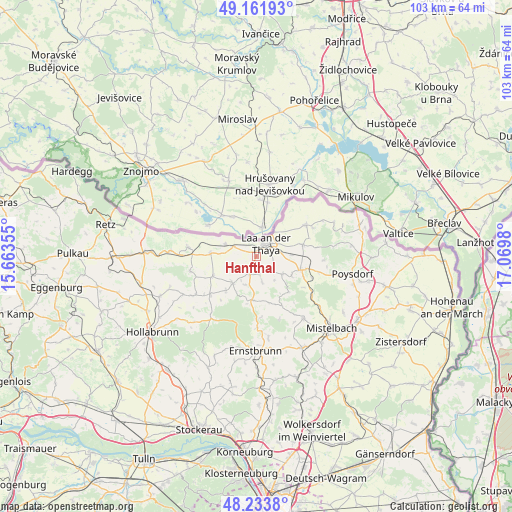
Hanfthal GPS coordinates[2]
48° 42' 0" North, 16° 22' 0.012" East
| Map corner | latitude | longitude |
|---|---|---|
| Upper-left | 49.16193°, | 15.66355° |
| Center: | 48.7°, | 16.36667° |
| Lower-right: | 48.2338°, | 17.0698° |
| Map W x H: | 103.2×103.2 km | = 64.1×64.1mi |
| max Lat: | 48.98333° ⇑1.9% North |
| Hanfthal: | 48.7° |
| min Lat: | ⇓98.1% South 46.48841° |
| min Long | Hanfthal | max Long |
| 9.57802° | 16.36667° | 17.1° |
| W 90.2%⇐ | ⇒9.8% E |
Elevation
Elevation of Hanfthal is 183 m = 600 ft, and this is 322.5 m = 1058 ft below average elevation for this country.
| Max E: |
2140 m = 7021 ft | 94.4% |
| Avg. | 505.5 m = 1658 ft | |
| Hanfthal | 183 m = 600 ft | |
Min E: |
118 m = 387 ft | 5.6% |
See also: Austria elevation on elevation.city.
Geographical zone
Hanfthal is located in North temperate zone (between Tropic of Cancer and the Arctic Circle). Distance of this North polar circle is 1986.2 km =1234.2 mi to North.| Distance of | km | miles | from Hanfthal |
|---|---|---|---|
| North Pole | 4592.1 | 2853.4 | to North |
| Arctic Circle | 1986.2 | 1234.2 | to North |
| Tropic Cancer | 2809 | 1745.4 | to South |
| Equator | 5414.9 | 3364.7 | to South |


Nearby cities:
15 places around Hanfthal: (largest is in red/bold)
• Fallbach
6.7 km =4.2 mi,  146°
146°
• Gaubitsch
5.7 km =3.5 mi,  167°
167°
• Gnadendorf
9.6 km =6 mi, 165°
• Großharras
9.8 km =6.1 mi,  245°
245°
• Großkadolz
13.3 km =8.3 mi,  275°
275°
• Kautendorf
9.3 km =5.8 mi,  113°
113°
• Laa an der Thaya
2.2 km =1.4 mi,  33°
33°
• Mailberg
13.9 km =8.6 mi,  257°
257°
• Neudorf bei Staatz
9.4 km =5.8 mi,  75°
75°
• Obritz
15.9 km =9.9 mi,  270°
270°
• Staatz
9.2 km =5.7 mi, 106°
• Stronsdorf
7.3 km =4.5 mi,  222°
222°
• Unterstinkenbrunn
3.9 km =2.4 mi,  202°
202°
• Wildendürnbach
11.8 km =7.3 mi,  57°
57°
• Wulzeshofen
5.2 km =3.2 mi,  290°
290°
Sources, notices
• [Note1] Compared only with cities in Austria existing in our database
• [Src1] Map data: © OpenStreetMap contributors (CC-BY-SA)
• [Src2] Other city data from geonames.org with taken over terms of usage.
• [Src3] Geographical zone / Annual Mean Temperature by Robert A. Rohde @ Wikipedia
