Kronstorf geodata
Kronstorf (Upper Austria) is a populated place; located in Austria in Europe/Vienna (GMT+2) time zone. With population of 1,617 people, there are 771 cities with bigger population in this country. Compared to other cities in Austria, 75.1% of cities are located further ↓South; 54.2% of cities are located further →East and 80.8% of cities have higher elevation than Kronstorf. Note1
Administrative division(s):
- Level 1: Upper Austria
- Level 2: Politischer Bezirk Linz-Land
- Level 3: Kronstorf


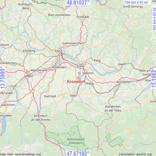
Kronstorf GPS coordinates[2]
48° 8' 35.664" North, 14° 27' 47.052" East
| Map corner | latitude | longitude |
|---|---|---|
| Upper-left | 48.61027°, | 13.75995° |
| Center: | 48.14324°, | 14.46307° |
| Lower-right: | 47.67192°, | 15.1662° |
| Map W x H: | 104.3×104.3 km | = 64.8×64.8mi |
| max Lat: | 48.98333° ⇑24.9% North |
| Kronstorf: | 48.14324° |
| min Lat: | ⇓75.1% South 46.48841° |
| min Long | Kronstorf | max Long |
| 9.57802° | 14.46307° | 17.1° |
| W 45.8%⇐ | ⇒54.2% E |
Elevation
Elevation of Kronstorf is 271 m = 889 ft, and this is 234.5 m = 769 ft below average elevation for this country.
| Max E: |
2140 m = 7021 ft | 80.8% |
| Avg. | 505.5 m = 1658 ft | |
| Kronstorf | 271 m = 889 ft | |
Min E: |
118 m = 387 ft | 19.2% |
See also: Austria elevation on elevation.city.
Geographical zone
Kronstorf is located in North temperate zone (between Tropic of Cancer and the Arctic Circle). Distance of this North polar circle is 2048.1 km =1272.6 mi to North.| Distance of | km | miles | from Kronstorf |
|---|---|---|---|
| North Pole | 4654 | 2891.9 | to North |
| Arctic Circle | 2048.1 | 1272.6 | to North |
| Tropic Cancer | 2747.1 | 1707 | to South |
| Equator | 5353 | 3326.2 | to South |


Nearby cities:
15 places around Kronstorf: (largest is in red/bold)
• Asten
9.1 km =5.7 mi,  338°
338°
• Dietach
6.8 km =4.2 mi,  210°
210°
• Dietachdorf
7.1 km =4.4 mi,  201°
201°
• Edelhof
7.7 km =4.8 mi,  111°
111°
• Enns
7.9 km =4.9 mi,  7°
7°
• Ennsdorf
8.2 km =5.1 mi,  21°
21°
• Ernsthofen
2 km =1.2 mi,  140°
140°
• Haag
8.4 km =5.2 mi, 113°
• Haidershofen
7.5 km =4.7 mi,  180°
180°
• Hiesendorf
5 km =3.1 mi, 12°
• Hofkirchen im Traunkreis
6.3 km =3.9 mi,  269°
269°
• Kristein
8.2 km =5.1 mi,  353°
353°
• Losensteinleithen
8.4 km =5.2 mi,  248°
248°
• Sankt Valentin
4.8 km =3 mi,  56°
56°
• Thaling
3.6 km =2.2 mi, 9°
Sources, notices
• [Note1] Compared only with cities in Austria existing in our database
• [Src1] Map data: © OpenStreetMap contributors (CC-BY-SA)
• [Src2] Other city data from geonames.org with taken over terms of usage.
• [Src3] Geographical zone / Annual Mean Temperature by Robert A. Rohde @ Wikipedia
