Karlstein geodata
Karlstein (Lower Austria) is a populated place; located in Austria in Europe/Vienna (GMT+2) time zone. With population of 610 people, there are 2104 cities with bigger population in this country. Compared to other cities in Austria, 99.7% of cities are located further ↓South; 62.5% of cities are located further ←West and 52.4% of cities have lower elevation than Karlstein. Note1
Administrative division(s):
- Level 1: Lower Austria
- Level 2: Politischer Bezirk Waidhofen an der Thaya
- Level 3: Karlstein an der Thaya


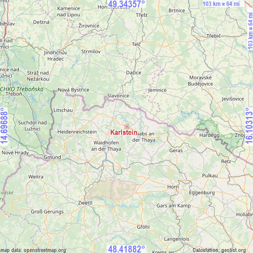
Karlstein GPS coordinates[2]
48° 52' 59.988" North, 15° 24' 0" East
| Map corner | latitude | longitude |
|---|---|---|
| Upper-left | 49.34357°, | 14.69688° |
| Center: | 48.88333°, | 15.4° |
| Lower-right: | 48.41882°, | 16.10313° |
| Map W x H: | 102.8×102.8 km | = 63.9×63.9mi |
| max Lat: | 48.98333° ⇑0.3% North |
| Karlstein: | 48.88333° |
| min Lat: | ⇓99.7% South 46.48841° |
| min Long | Karlstein | max Long |
| 9.57802° | 15.4° | 17.1° |
| W 62.5%⇐ | ⇒37.5% E |
Elevation
Elevation of Karlstein is 468 m = 1535 ft, and this is 37.5 m = 123 ft below average elevation for this country.
| Max E: |
2140 m = 7021 ft | 47.6% |
| Avg. | 505.5 m = 1658 ft | |
| Karlstein | 468 m = 1535 ft | |
Min E: |
118 m = 387 ft | 52.4% |
See also: Austria elevation on elevation.city.
Geographical zone
Karlstein is located in North temperate zone (between Tropic of Cancer and the Arctic Circle). Distance of this North polar circle is 1965.9 km =1221.6 mi to North.| Distance of | km | miles | from Karlstein |
|---|---|---|---|
| North Pole | 4571.7 | 2840.7 | to North |
| Arctic Circle | 1965.9 | 1221.6 | to North |
| Tropic Cancer | 2829.4 | 1758.1 | to South |
| Equator | 5435.3 | 3377.3 | to South |


Nearby cities:
15 places around Karlstein: (largest is in red/bold)
• Alt-Dietmanns
10.2 km =6.3 mi,  186°
186°
• Dobersberg
6.7 km =4.2 mi,  301°
301°
• Drosendorf
16.3 km =10.1 mi,  96°
96°
• Eggern
18.6 km =11.6 mi,  278°
278°
• Gastern
13.2 km =8.2 mi, 275°
• Groß-Siegharts
10.2 km =6.3 mi,  178°
178°
• Göpfritz an der Wild
17.6 km =10.9 mi, 179°
• Japons
15.9 km =9.9 mi,  129°
129°
• Kautzen
12.8 km =8 mi,  293°
293°
• Raabs an der Thaya
8.2 km =5.1 mi,  116°
116°
• Schwarzenau
18.6 km =11.6 mi,  213°
213°
• Thaya
8.7 km =5.4 mi,  248°
248°
• Waidhofen an der Thaya
11.3 km =7 mi,  229°
229°
• Waldkirchen an der Thaya
6.7 km =4.2 mi,  326°
326°
• Windigsteig
15.5 km =9.6 mi, 213°
Sources, notices
• [Note1] Compared only with cities in Austria existing in our database
• [Src1] Map data: © OpenStreetMap contributors (CC-BY-SA)
• [Src2] Other city data from geonames.org with taken over terms of usage.
• [Src3] Geographical zone / Annual Mean Temperature by Robert A. Rohde @ Wikipedia
