Kaltenleutgeben geodata
Kaltenleutgeben (Lower Austria) is a seat of a third-order administrative division; located in Austria in Europe/Vienna (GMT+2) time zone. With population of 3,276 people, there are 336 cities with bigger population in this country. Compared to other cities in Austria, 73.6% of cities are located further ↓South; 85.9% of cities are located further ←West and 68.8% of cities have higher elevation than Kaltenleutgeben. Note1
Administrative division(s):
- Level 1: Lower Austria
- Level 2: Politischer Bezirk Mödling
- Level 3: Kaltenleutgeben


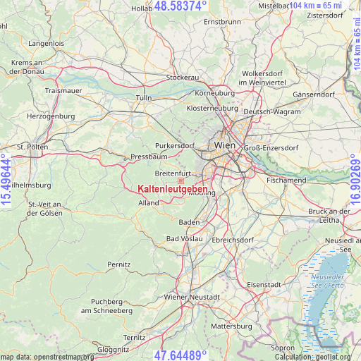
Kaltenleutgeben GPS coordinates[2]
48° 6' 59.256" North, 16° 11' 58.416" East
| Map corner | latitude | longitude |
|---|---|---|
| Upper-left | 48.58374°, | 15.49644° |
| Center: | 48.11646°, | 16.19956° |
| Lower-right: | 47.64489°, | 16.90269° |
| Map W x H: | 104.4×104.4 km | = 64.9×64.9mi |
| max Lat: | 48.98333° ⇑26.4% North |
| Kaltenleutgeben: | 48.11646° |
| min Lat: | ⇓73.6% South 46.48841° |
| min Long | Kaltenleutgeben | max Long |
| 9.57802° | 16.19956° | 17.1° |
| W 85.9%⇐ | ⇒14.1% E |
Elevation
Elevation of Kaltenleutgeben is 335 m = 1099 ft, and this is 170.5 m = 559 ft below average elevation for this country.
| Max E: |
2140 m = 7021 ft | 68.8% |
| Avg. | 505.5 m = 1658 ft | |
| Kaltenleutgeben | 335 m = 1099 ft | |
Min E: |
118 m = 387 ft | 31.2% |
See also: Austria elevation on elevation.city.
Geographical zone
Kaltenleutgeben is located in North temperate zone (between Tropic of Cancer and the Arctic Circle). Distance of this North polar circle is 2051.1 km =1274.5 mi to North.| Distance of | km | miles | from Kaltenleutgeben |
|---|---|---|---|
| North Pole | 4657 | 2893.7 | to North |
| Arctic Circle | 2051.1 | 1274.5 | to North |
| Tropic Cancer | 2744.1 | 1705.1 | to South |
| Equator | 5350 | 3324.3 | to South |


Nearby cities:
15 places around Kaltenleutgeben: (largest is in red/bold)
• Breitenfurt bei Wien
4.1 km =2.5 mi,  297°
297°
• Brunn am Gebirge
6.4 km =4 mi,  99°
99°
• Gaaden
7 km =4.3 mi,  179°
179°
• Gießhübl
3.3 km =2.1 mi,  128°
128°
• Grub
7.7 km =4.8 mi,  237°
237°
• Heiligenkreuz
8.7 km =5.4 mi,  219°
219°
• Hinterbrühl
4.9 km =3 mi, 133°
• Laab im Walde
4.7 km =2.9 mi,  335°
335°
• Maria Enzersdorf
6.5 km =4 mi,  106°
106°
• Mödling
7.5 km =4.7 mi,  116°
116°
• Perchtoldsdorf
4.9 km =3 mi,  86°
86°
• Siegenfeld
9.1 km =5.7 mi,  191°
191°
• Sittendorf
5.3 km =3.3 mi,  211°
211°
• Sulz im Wienerwald
4.9 km =3 mi,  248°
248°
• Wolfsgraben
7.5 km =4.7 mi,  308°
308°
Sources, notices
• [Note1] Compared only with cities in Austria existing in our database
• [Src1] Map data: © OpenStreetMap contributors (CC-BY-SA)
• [Src2] Other city data from geonames.org with taken over terms of usage.
• [Src3] Geographical zone / Annual Mean Temperature by Robert A. Rohde @ Wikipedia
