Hürm geodata
Hürm (Lower Austria) is a seat of a third-order administrative division; located in Austria in Europe/Vienna (GMT+2) time zone. With population of 664 people, there are 1948 cities with bigger population in this country. Compared to other cities in Austria, 76.1% of cities are located further ↓South; 63.1% of cities are located further ←West and 80% of cities have higher elevation than Hürm. Note1


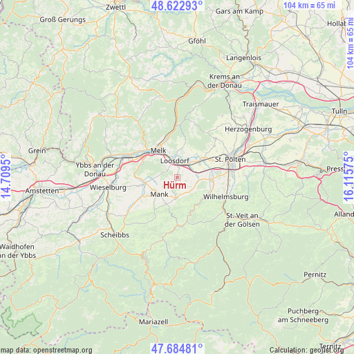
Hürm GPS coordinates[2]
48° 9' 21.636" North, 15° 24' 45.432" East
| Map corner | latitude | longitude |
|---|---|---|
| Upper-left | 48.62293°, | 14.7095° |
| Center: | 48.15601°, | 15.41262° |
| Lower-right: | 47.68481°, | 16.11575° |
| Map W x H: | 104.3×104.3 km | = 64.8×64.8mi |
| max Lat: | 48.98333° ⇑23.9% North |
| Hürm: | 48.15601° |
| min Lat: | ⇓76.1% South 46.48841° |
| min Long | Hürm | max Long |
| 9.57802° | 15.41262° | 17.1° |
| W 63.1%⇐ | ⇒36.9% E |
Elevation
Elevation of Hürm is 275 m = 902 ft, and this is 230.5 m = 756 ft below average elevation for this country.
| Max E: |
2140 m = 7021 ft | 80% |
| Avg. | 505.5 m = 1658 ft | |
| Hürm | 275 m = 902 ft | |
Min E: |
118 m = 387 ft | 20% |
See also: Austria elevation on elevation.city.
Geographical zone
Hürm is located in North temperate zone (between Tropic of Cancer and the Arctic Circle). Distance of this North polar circle is 2046.7 km =1271.8 mi to North.| Distance of | km | miles | from Hürm |
|---|---|---|---|
| North Pole | 4652.6 | 2891 | to North |
| Arctic Circle | 2046.7 | 1271.8 | to North |
| Tropic Cancer | 2748.5 | 1707.8 | to South |
| Equator | 5354.4 | 3327.1 | to South |


Nearby cities:
15 places around Hürm: (largest is in red/bold)
• Bischofstetten
5.6 km =3.5 mi,  131°
131°
• Groß Sierning
5.3 km =3.3 mi,  39°
39°
• Hafnerbach
8.5 km =5.3 mi, 37°
• Haunoldstein
5.6 km =3.5 mi,  29°
29°
• Hofstetten
9.8 km =6.1 mi, 131°
• Kilb
6.1 km =3.8 mi,  182°
182°
• Loosdorf
5 km =3.1 mi,  349°
349°
• Mank
7.5 km =4.7 mi,  226°
226°
• Markersdorf an der Pielach
7.2 km =4.5 mi,  64°
64°
• Mauer bei Melk
7.9 km =4.9 mi,  1°
1°
• Melk
9.9 km =6.2 mi,  322°
322°
• Ober-Grafendorf
9.9 km =6.2 mi,  93°
93°
• Prinzersdorf
9.1 km =5.7 mi, 57°
• Sankt Leonhard am Forst
9.6 km =6 mi,  260°
260°
• Sankt Margarethen an der Sierning
5.8 km =3.6 mi, 86°
Sources, notices
• [Note1] Compared only with cities in Austria existing in our database
• [Src1] Map data: © OpenStreetMap contributors (CC-BY-SA)
• [Src2] Other city data from geonames.org with taken over terms of usage.
• [Src3] Geographical zone / Annual Mean Temperature by Robert A. Rohde @ Wikipedia
