Kilb geodata
Kilb (Lower Austria) is a seat of a third-order administrative division; located in Austria in Europe/Vienna (GMT+2) time zone. With population of 1,229 people, there are 1026 cities with bigger population in this country. Compared to other cities in Austria, 72.9% of cities are located further ↓South; 63% of cities are located further ←West and 75.5% of cities have higher elevation than Kilb. Note1


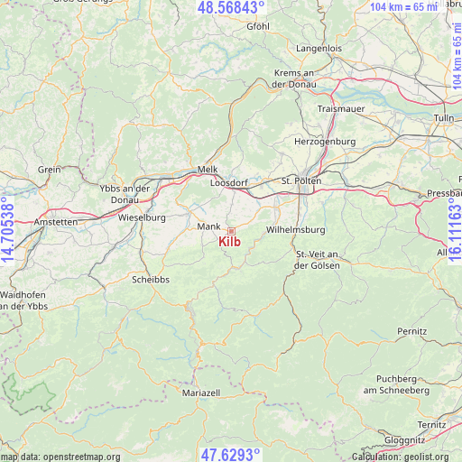
Kilb GPS coordinates[2]
48° 6' 3.636" North, 15° 24' 30.6" East
| Map corner | latitude | longitude |
|---|---|---|
| Upper-left | 48.56843°, | 14.70538° |
| Center: | 48.10101°, | 15.4085° |
| Lower-right: | 47.6293°, | 16.11163° |
| Map W x H: | 104.4×104.4 km | = 64.9×64.9mi |
| max Lat: | 48.98333° ⇑27.1% North |
| Kilb: | 48.10101° |
| min Lat: | ⇓72.9% South 46.48841° |
| min Long | Kilb | max Long |
| 9.57802° | 15.4085° | 17.1° |
| W 63%⇐ | ⇒37% E |
Elevation
Elevation of Kilb is 299 m = 981 ft, and this is 206.5 m = 677 ft below average elevation for this country.
| Max E: |
2140 m = 7021 ft | 75.5% |
| Avg. | 505.5 m = 1658 ft | |
| Kilb | 299 m = 981 ft | |
Min E: |
118 m = 387 ft | 24.5% |
See also: Austria elevation on elevation.city.
Geographical zone
Kilb is located in North temperate zone (between Tropic of Cancer and the Arctic Circle). Distance of this North polar circle is 2052.8 km =1275.6 mi to North.| Distance of | km | miles | from Kilb |
|---|---|---|---|
| North Pole | 4658.7 | 2894.8 | to North |
| Arctic Circle | 2052.8 | 1275.6 | to North |
| Tropic Cancer | 2742.4 | 1704 | to South |
| Equator | 5348.3 | 3323.3 | to South |


Nearby cities:
15 places around Kilb: (largest is in red/bold)
• Bischofstetten
5.1 km =3.2 mi,  62°
62°
• Dorf Au
5.6 km =3.5 mi,  132°
132°
• Groß Sierning
10.9 km =6.8 mi,  19°
19°
• Haunoldstein
11.4 km =7.1 mi, 15°
• Hofstetten
7.7 km =4.8 mi,  93°
93°
• Hürm
6.1 km =3.8 mi,  2°
2°
• Kirchberg an der Pielach
8.4 km =5.2 mi,  169°
169°
• Kirnberg an der Mank
7.1 km =4.4 mi,  243°
243°
• Loosdorf
11 km =6.8 mi,  356°
356°
• Mank
5.3 km =3.3 mi,  281°
281°
• Rabenstein an der Pielach
5.9 km =3.7 mi, 132°
• Ruprechtshofen
10.5 km =6.5 mi,  291°
291°
• Sankt Leonhard am Forst
10.3 km =6.4 mi,  296°
296°
• Sankt Margarethen an der Sierning
8.9 km =5.5 mi,  43°
43°
• Weinburg
9.3 km =5.8 mi,  81°
81°
Sources, notices
• [Note1] Compared only with cities in Austria existing in our database
• [Src1] Map data: © OpenStreetMap contributors (CC-BY-SA)
• [Src2] Other city data from geonames.org with taken over terms of usage.
• [Src3] Geographical zone / Annual Mean Temperature by Robert A. Rohde @ Wikipedia
