Rohr im Gebirge geodata
Rohr im Gebirge (Lower Austria) is a seat of a third-order administrative division; located in Austria in Europe/Vienna (GMT+2) time zone. With population of 476 people, there are 2533 cities with bigger population in this country. Compared to other cities in Austria, 60.8% of cities are located further ↓South; 73.1% of cities are located further ←West and 76.7% of cities have lower elevation than Rohr im Gebirge. Note1
Administrative division(s):
- Level 1: Lower Austria
- Level 2: Politischer Bezirk Wiener Neustadt
- Level 3: Rohr im Gebirge


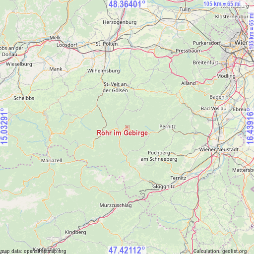
Rohr im Gebirge GPS coordinates[2]
47° 53' 40.956" North, 15° 44' 9.708" East
| Map corner | latitude | longitude |
|---|---|---|
| Upper-left | 48.36401°, | 15.03291° |
| Center: | 47.89471°, | 15.73603° |
| Lower-right: | 47.42112°, | 16.43916° |
| Map W x H: | 104.8×104.8 km | = 65.1×65.1mi |
| max Lat: | 48.98333° ⇑39.2% North |
| Rohr im Gebirge: | 47.89471° |
| min Lat: | ⇓60.8% South 46.48841° |
| min Long | Rohr im Gebirge | max Long |
| 9.57802° | 15.73603° | 17.1° |
| W 73.1%⇐ | ⇒26.9% E |
Elevation
Elevation of Rohr im Gebirge is 673 m = 2208 ft, and this is 167.5 m = 550 ft above average elevation for this country.
| Max E: |
2140 m = 7021 ft | 23.3% |
| Rohr im Gebirge | 673 m 2208 ft | |
| Avg. | 505.5 m = 1658 ft | |
Min E: |
118 m = 387 ft | 76.7% |
See also: Austria elevation on elevation.city.
Geographical zone
Rohr im Gebirge is located in North temperate zone (between Tropic of Cancer and the Arctic Circle). Distance of this North polar circle is 2075.8 km =1289.8 mi to North.| Distance of | km | miles | from Rohr im Gebirge |
|---|---|---|---|
| North Pole | 4681.7 | 2909.1 | to North |
| Arctic Circle | 2075.8 | 1289.8 | to North |
| Tropic Cancer | 2719.5 | 1689.8 | to South |
| Equator | 5325.4 | 3309 | to South |


Nearby cities:
15 places around Rohr im Gebirge: (largest is in red/bold)
• Gutenstein
11.6 km =7.2 mi,  100°
100°
• Gölsen
16.4 km =10.2 mi,  1°
1°
• Hainfeld
15.7 km =9.8 mi,  10°
10°
• Hohenberg
8.8 km =5.5 mi,  278°
278°
• Kleinzell
9.5 km =5.9 mi, 0°
• Lilienfeld
16.8 km =10.4 mi,  321°
321°
• Muggendorf
15 km =9.3 mi,  83°
83°
• Neusiedl
16.9 km =10.5 mi,  92°
92°
• Pernitz
16.7 km =10.4 mi, 88°
• Rainfeld
17.1 km =10.6 mi,  353°
353°
• Ramsau
13.1 km =8.1 mi,  22°
22°
• Rohrbach an der Gölsen
16.9 km =10.5 mi, 1°
• Sankt Aegyd am Neuwalde
13.2 km =8.2 mi,  249°
249°
• Schwarzau im Gebirge
9.4 km =5.8 mi,  193°
193°
• Vorderbruck
12.9 km =8 mi, 98°
Sources, notices
• [Note1] Compared only with cities in Austria existing in our database
• [Src1] Map data: © OpenStreetMap contributors (CC-BY-SA)
• [Src2] Other city data from geonames.org with taken over terms of usage.
• [Src3] Geographical zone / Annual Mean Temperature by Robert A. Rohde @ Wikipedia
