Lofer geodata
Lofer (Salzburg) is a seat of a third-order administrative division; located in Austria in Europe/Vienna (GMT+2) time zone. With population of 1,185 people, there are 1063 cities with bigger population in this country. Compared to other cities in Austria, 50.1% of cities are located further ↑North; 85.3% of cities are located further →East and 73.1% of cities have lower elevation than Lofer. Note1
Administrative division(s):
- Level 1: Salzburg
- Level 2: Politischer Bezirk Zell am See
- Level 3: Lofer


Lofer GPS coordinates[2]
47° 35' 5.1" North, 12° 41' 35.988" East
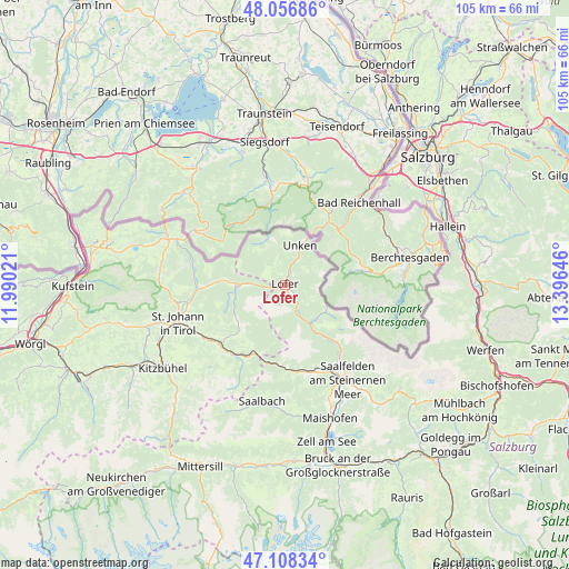
| Map corner | latitude | longitude |
|---|---|---|
| Upper-left | 48.05686°, | 11.99021° |
| Center: | 47.58475°, | 12.69333° |
| Lower-right: | 47.10834°, | 13.39646° |
| Map W x H: | 105.5×105.5 km | = 65.6×65.6mi |
| max Lat: | 48.98333° ⇑50.1% North |
| Lofer: | 47.58475° |
| min Lat: | ⇓49.9% South 46.48841° |
| min Long | Lofer | max Long |
| 9.57802° | 12.69333° | 17.1° |
| W 14.7%⇐ | ⇒85.3% E |
Elevation
Elevation of Lofer is 626 m = 2054 ft, and this is 120.5 m = 395 ft above average elevation for this country.
| Max E: |
2140 m = 7021 ft | 26.9% |
| Lofer | 626 m 2054 ft | |
| Avg. | 505.5 m = 1658 ft | |
Min E: |
118 m = 387 ft | 73.1% |
See also: Austria elevation on elevation.city.
Geographical zone
Lofer is located in North temperate zone (between Tropic of Cancer and the Arctic Circle). Distance of this North polar circle is 2110.2 km =1311.2 mi to North.| Distance of | km | miles | from Lofer |
|---|---|---|---|
| North Pole | 4716.1 | 2930.4 | to North |
| Arctic Circle | 2110.2 | 1311.2 | to North |
| Tropic Cancer | 2685 | 1668.4 | to South |
| Equator | 5290.9 | 3287.6 | to South |


Nearby cities:
15 places around Lofer: (largest is in red/bold)
• Dorfheim
19.9 km =12.4 mi,  147°
147°
• Erpfendorf
17 km =10.6 mi,  269°
269°
• Fieberbrunn
16.5 km =10.3 mi,  223°
223°
• Hochfilzen
14.3 km =8.9 mi,  203°
203°
• Kirchdorf in Tirol
18.9 km =11.7 mi,  260°
260°
• Lenzing
17.8 km =11.1 mi, 149°
• Leogang
17 km =10.6 mi,  162°
162°
• Niederland
9.6 km =6 mi,  18°
18°
• Saalfelden am Steinernen Meer
21.1 km =13.1 mi, 146°
• Sankt Jakob in Haus
14.3 km =8.9 mi,  228°
228°
• Sankt Martin bei Lofer
2.1 km =1.3 mi,  166°
166°
• Sankt Ulrich am Pillersee
11.1 km =6.9 mi, 234°
• Sonnberg
15.3 km =9.5 mi, 168°
• Unken
7.7 km =4.8 mi, 20°
• Waidring
9.5 km =5.9 mi, 269°
Sources, notices
• [Note1] Compared only with cities in Austria existing in our database
• [Src1] Map data: © OpenStreetMap contributors (CC-BY-SA)
• [Src2] Other city data from geonames.org with taken over terms of usage.
• [Src3] Geographical zone / Annual Mean Temperature by Robert A. Rohde @ Wikipedia
