Heiligeneich geodata
Heiligeneich (Lower Austria) is a populated place; located in Austria in Europe/Vienna (GMT+2) time zone. With population of 1,066 people, there are 1199 cities with bigger population in this country. Compared to other cities in Austria, 85.8% of cities are located further ↓South; 77.1% of cities are located further ←West and 92% of cities have higher elevation than Heiligeneich. Note1
Administrative division(s):
- Level 1: Lower Austria
- Level 2: Politischer Bezirk Tulln
- Level 3: Atzenbrugg


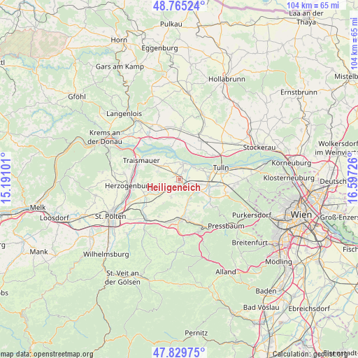
Heiligeneich GPS coordinates[2]
48° 17' 58.704" North, 15° 53' 38.868" East
| Map corner | latitude | longitude |
|---|---|---|
| Upper-left | 48.76524°, | 15.19101° |
| Center: | 48.29964°, | 15.89413° |
| Lower-right: | 47.82975°, | 16.59726° |
| Map W x H: | 104×104 km | = 64.6×64.6mi |
| max Lat: | 48.98333° ⇑14.2% North |
| Heiligeneich: | 48.29964° |
| min Lat: | ⇓85.8% South 46.48841° |
| min Long | Heiligeneich | max Long |
| 9.57802° | 15.89413° | 17.1° |
| W 77.1%⇐ | ⇒22.9% E |
Elevation
Elevation of Heiligeneich is 201 m = 659 ft, and this is 304.5 m = 999 ft below average elevation for this country.
| Max E: |
2140 m = 7021 ft | 92% |
| Avg. | 505.5 m = 1658 ft | |
| Heiligeneich | 201 m = 659 ft | |
Min E: |
118 m = 387 ft | 8% |
See also: Austria elevation on elevation.city.
Geographical zone
Heiligeneich is located in North temperate zone (between Tropic of Cancer and the Arctic Circle). Distance of this North polar circle is 2030.8 km =1261.9 mi to North.| Distance of | km | miles | from Heiligeneich |
|---|---|---|---|
| North Pole | 4636.6 | 2881 | to North |
| Arctic Circle | 2030.8 | 1261.9 | to North |
| Tropic Cancer | 2764.5 | 1717.8 | to South |
| Equator | 5370.4 | 3337 | to South |


Nearby cities:
15 places around Heiligeneich: (largest is in red/bold)
• Asperhofen
6.4 km =4 mi,  158°
158°
• Atzenbrugg
1.3 km =0.8 mi,  136°
136°
• Au am Anzbach
11.1 km =6.9 mi,  169°
169°
• Baumgarten am Tullnerfeld
10.5 km =6.5 mi,  99°
99°
• Erpersdorf
5 km =3.1 mi,  20°
20°
• Gemeinlebarn
7.7 km =4.8 mi,  301°
301°
• Judenau
8.7 km =5.4 mi, 101°
• Kapelln
11.1 km =6.9 mi,  245°
245°
• Langenrohr
8.6 km =5.3 mi,  86°
86°
• Michelhausen
3.5 km =2.2 mi,  106°
106°
• Reidling
6 km =3.7 mi,  291°
291°
• Sieghartskirchen
10 km =6.2 mi,  119°
119°
• Trasdorf
1.9 km =1.2 mi,  321°
321°
• Würmla
5.6 km =3.5 mi,  206°
206°
• Zwentendorf
5.2 km =3.2 mi,  13°
13°
Sources, notices
• [Note1] Compared only with cities in Austria existing in our database
• [Src1] Map data: © OpenStreetMap contributors (CC-BY-SA)
• [Src2] Other city data from geonames.org with taken over terms of usage.
• [Src3] Geographical zone / Annual Mean Temperature by Robert A. Rohde @ Wikipedia
