Heiligenbrunn geodata
Heiligenbrunn (Burgenland) is a seat of a third-order administrative division; located in Austria in Europe/Vienna (GMT+2) time zone. With population of 244 people, there are 2816 cities with bigger population in this country. Compared to other cities in Austria, 82.9% of cities are located further ↑North; 91.9% of cities are located further ←West and 90.4% of cities have higher elevation than Heiligenbrunn. Note1
Administrative division(s):
- Level 1: Burgenland
- Level 2: Politischer Bezirk Güssing
- Level 3: Heiligenbrunn


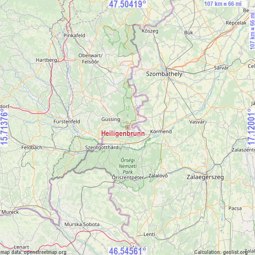
Heiligenbrunn GPS coordinates[2]
47° 1' 37.38" North, 16° 25' 0.768" East
| Map corner | latitude | longitude |
|---|---|---|
| Upper-left | 47.50419°, | 15.71376° |
| Center: | 47.02705°, | 16.41688° |
| Lower-right: | 46.54561°, | 17.12001° |
| Map W x H: | 106.6×106.6 km | = 66.2×66.2mi |
| max Lat: | 48.98333° ⇑82.9% North |
| Heiligenbrunn: | 47.02705° |
| min Lat: | ⇓17.1% South 46.48841° |
| min Long | Heiligenbrunn | max Long |
| 9.57802° | 16.41688° | 17.1° |
| W 91.9%⇐ | ⇒8.1% E |
Elevation
Elevation of Heiligenbrunn is 211 m = 692 ft, and this is 294.5 m = 966 ft below average elevation for this country.
| Max E: |
2140 m = 7021 ft | 90.4% |
| Avg. | 505.5 m = 1658 ft | |
| Heiligenbrunn | 211 m = 692 ft | |
Min E: |
118 m = 387 ft | 9.6% |
See also: Austria elevation on elevation.city.
Geographical zone
Heiligenbrunn is located in North temperate zone (between Tropic of Cancer and the Arctic Circle). Distance of this North polar circle is 2172.3 km =1349.8 mi to North.| Distance of | km | miles | from Heiligenbrunn |
|---|---|---|---|
| North Pole | 4778.1 | 2969 | to North |
| Arctic Circle | 2172.3 | 1349.8 | to North |
| Tropic Cancer | 2623 | 1629.9 | to South |
| Equator | 5228.9 | 3249.1 | to South |


Nearby cities:
15 places around Heiligenbrunn: (largest is in red/bold)
• Deutsch Tschantschendorf
13 km =8.1 mi,  308°
308°
• Eberau
9.5 km =5.9 mi,  20°
20°
• Eltendorf
16.4 km =10.2 mi,  262°
262°
• Güssing
7.9 km =4.9 mi,  297°
297°
• Heiligenkreuz im Lafnitztal
12.6 km =7.8 mi,  250°
250°
• Inzenhof
7.7 km =4.8 mi, 261°
• Kleinmürbisch
7 km =4.3 mi,  275°
275°
• Kukmirn
16.5 km =10.3 mi,  288°
288°
• Mogersdorf
16.5 km =10.3 mi,  238°
238°
• Moschendorf
5.8 km =3.6 mi,  52°
52°
• Neustift bei Güssing
11.9 km =7.4 mi,  268°
268°
• Sankt Michael im Burgenland
15.8 km =9.8 mi,  315°
315°
• Strem
2 km =1.2 mi,  354°
354°
• Tobaj
10.8 km =6.7 mi, 305°
• Tschanigraben
8.9 km =5.5 mi, 262°
Sources, notices
• [Note1] Compared only with cities in Austria existing in our database
• [Src1] Map data: © OpenStreetMap contributors (CC-BY-SA)
• [Src2] Other city data from geonames.org with taken over terms of usage.
• [Src3] Geographical zone / Annual Mean Temperature by Robert A. Rohde @ Wikipedia
