Haschendorf geodata
Haschendorf (Lower Austria) is a populated place; located in Austria in Europe/Vienna (GMT+2) time zone. With population of 599 people, there are 2144 cities with bigger population in this country. Compared to other cities in Austria, 60.5% of cities are located further ↓South; 89.7% of cities are located further ←West and 88.2% of cities have higher elevation than Haschendorf. Note1
Administrative division(s):
- Level 1: Lower Austria
- Level 2: Politischer Bezirk Wiener Neustadt
- Level 3: Ebenfurth


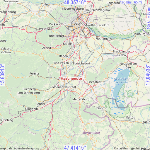
Haschendorf GPS coordinates[2]
47° 53' 16.08" North, 16° 20' 32.1" East
| Map corner | latitude | longitude |
|---|---|---|
| Upper-left | 48.35716°, | 15.63913° |
| Center: | 47.8878°, | 16.34225° |
| Lower-right: | 47.41415°, | 17.04538° |
| Map W x H: | 104.9×104.9 km | = 65.2×65.2mi |
| max Lat: | 48.98333° ⇑39.5% North |
| Haschendorf: | 47.8878° |
| min Lat: | ⇓60.5% South 46.48841° |
| min Long | Haschendorf | max Long |
| 9.57802° | 16.34225° | 17.1° |
| W 89.7%⇐ | ⇒10.3% E |
Elevation
Elevation of Haschendorf is 228 m = 748 ft, and this is 277.5 m = 910 ft below average elevation for this country.
| Max E: |
2140 m = 7021 ft | 88.2% |
| Avg. | 505.5 m = 1658 ft | |
| Haschendorf | 228 m = 748 ft | |
Min E: |
118 m = 387 ft | 11.8% |
See also: Austria elevation on elevation.city.
Geographical zone
Haschendorf is located in North temperate zone (between Tropic of Cancer and the Arctic Circle). Distance of this North polar circle is 2076.5 km =1290.3 mi to North.| Distance of | km | miles | from Haschendorf |
|---|---|---|---|
| North Pole | 4682.4 | 2909.5 | to North |
| Arctic Circle | 2076.5 | 1290.3 | to North |
| Tropic Cancer | 2718.7 | 1689.3 | to South |
| Equator | 5324.6 | 3308.6 | to South |


Nearby cities:
15 places around Haschendorf: (largest is in red/bold)
• Ebenfurth
2.2 km =1.4 mi,  121°
121°
• Eggendorf
3.6 km =2.2 mi,  204°
204°
• Felixdorf
7.5 km =4.7 mi,  264°
264°
• Hornstein
7.7 km =4.8 mi,  96°
96°
• Landegg
4.5 km =2.8 mi,  72°
72°
• Lichtenwörth
7.4 km =4.6 mi,  205°
205°
• Neufeld an der Leitha
3.7 km =2.3 mi,  132°
132°
• Pottendorf
3.3 km =2.1 mi, 66°
• Siegersdorf
1.5 km =0.9 mi,  23°
23°
• Sollenau
7.1 km =4.4 mi,  279°
279°
• Tattendorf
7.6 km =4.7 mi,  335°
335°
• Wampersdorf
6.4 km =4 mi,  59°
59°
• Wimpassing an der Leitha
7.5 km =4.7 mi, 64°
• Zillingdorf
4.3 km =2.7 mi,  188°
188°
• Zillingdorf-Bergwerk
5.7 km =3.5 mi,  149°
149°
Sources, notices
• [Note1] Compared only with cities in Austria existing in our database
• [Src1] Map data: © OpenStreetMap contributors (CC-BY-SA)
• [Src2] Other city data from geonames.org with taken over terms of usage.
• [Src3] Geographical zone / Annual Mean Temperature by Robert A. Rohde @ Wikipedia
