Eggendorf geodata
Eggendorf (Lower Austria) is a seat of a third-order administrative division; located in Austria in Europe/Vienna (GMT+2) time zone. With population of 4,794 people, there are 201 cities with bigger population in this country. Compared to other cities in Austria, 59.3% of cities are located further ↓South; 89.3% of cities are located further ←West and 86.4% of cities have higher elevation than Eggendorf. Note1
Administrative division(s):
- Level 1: Lower Austria
- Level 2: Politischer Bezirk Wiener Neustadt
- Level 3: Eggendorf


Eggendorf GPS coordinates[2]
47° 51' 29.124" North, 16° 19' 18.552" East
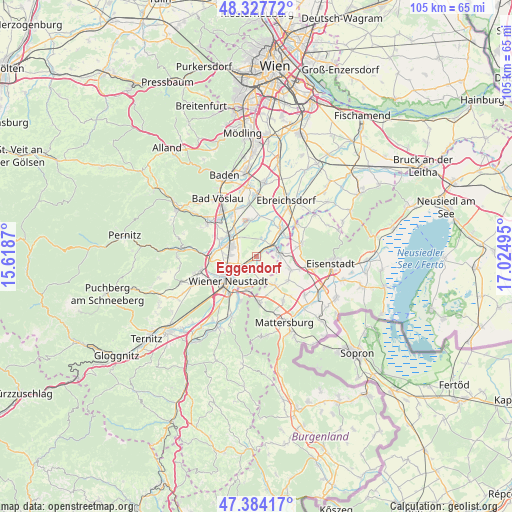
| Map corner | latitude | longitude |
|---|---|---|
| Upper-left | 48.32772°, | 15.6187° |
| Center: | 47.85809°, | 16.32182° |
| Lower-right: | 47.38417°, | 17.02495° |
| Map W x H: | 104.9×104.9 km | = 65.2×65.2mi |
| max Lat: | 48.98333° ⇑40.7% North |
| Eggendorf: | 47.85809° |
| min Lat: | ⇓59.3% South 46.48841° |
| min Long | Eggendorf | max Long |
| 9.57802° | 16.32182° | 17.1° |
| W 89.3%⇐ | ⇒10.7% E |
Elevation
Elevation of Eggendorf is 239 m = 784 ft, and this is 266.5 m = 874 ft below average elevation for this country.
| Max E: |
2140 m = 7021 ft | 86.4% |
| Avg. | 505.5 m = 1658 ft | |
| Eggendorf | 239 m = 784 ft | |
Min E: |
118 m = 387 ft | 13.6% |
See also: Austria elevation on elevation.city.
Geographical zone
Eggendorf is located in North temperate zone (between Tropic of Cancer and the Arctic Circle). Distance of this North polar circle is 2079.9 km =1292.4 mi to North.| Distance of | km | miles | from Eggendorf |
|---|---|---|---|
| North Pole | 4685.7 | 2911.6 | to North |
| Arctic Circle | 2079.9 | 1292.4 | to North |
| Tropic Cancer | 2715.4 | 1687.3 | to South |
| Equator | 5321.3 | 3306.5 | to South |


Nearby cities:
15 places around Eggendorf: (largest is in red/bold)
• Ebenfurth
4 km =2.5 mi,  57°
57°
• Felixdorf
6.5 km =4 mi,  293°
293°
• Haschendorf
3.6 km =2.2 mi,  24°
24°
• Landegg
7.5 km =4.7 mi,  51°
51°
• Lichtenwörth
3.8 km =2.4 mi,  206°
206°
• Neudörfl
7.1 km =4.4 mi,  194°
194°
• Neufeld an der Leitha
4.3 km =2.7 mi,  78°
78°
• Pottendorf
6.5 km =4 mi,  44°
44°
• Pöttsching
7 km =4.3 mi,  148°
148°
• Siegersdorf
5.1 km =3.2 mi, 24°
• Sollenau
7.1 km =4.4 mi,  309°
309°
• Steinbrunn
7.6 km =4.7 mi,  111°
111°
• Theresienfeld
6.7 km =4.2 mi,  262°
262°
• Zillingdorf
1.2 km =0.7 mi,  136°
136°
• Zillingdorf-Bergwerk
4.7 km =2.9 mi, 109°
Sources, notices
• [Note1] Compared only with cities in Austria existing in our database
• [Src1] Map data: © OpenStreetMap contributors (CC-BY-SA)
• [Src2] Other city data from geonames.org with taken over terms of usage.
• [Src3] Geographical zone / Annual Mean Temperature by Robert A. Rohde @ Wikipedia
