Gansbach geodata
Gansbach (Lower Austria) is a populated place; located in Austria in Europe/Vienna (GMT+2) time zone. With population of 501 people, there are 2505 cities with bigger population in this country. Compared to other cities in Austria, 86.2% of cities are located further ↓South; 64.7% of cities are located further ←West and 53.4% of cities have lower elevation than Gansbach. Note1
Administrative division(s):
- Level 1: Lower Austria
- Level 2: Politischer Bezirk Melk
- Level 3: Dunkelsteinerwald


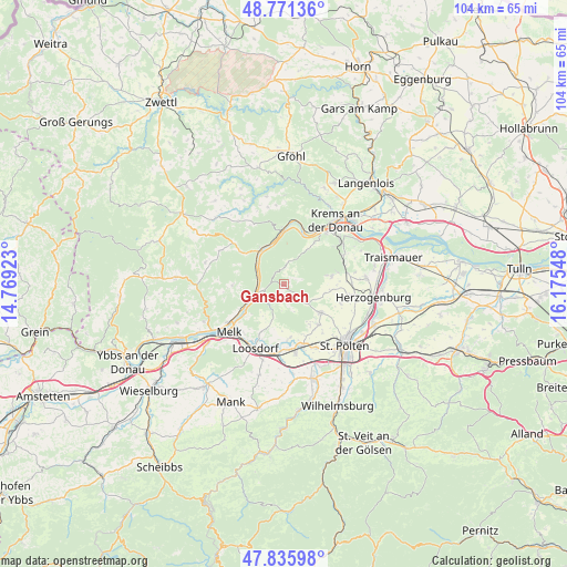
Gansbach GPS coordinates[2]
48° 18' 20.916" North, 15° 28' 20.46" East
| Map corner | latitude | longitude |
|---|---|---|
| Upper-left | 48.77136°, | 14.76923° |
| Center: | 48.30581°, | 15.47235° |
| Lower-right: | 47.83598°, | 16.17548° |
| Map W x H: | 104×104 km | = 64.6×64.6mi |
| max Lat: | 48.98333° ⇑13.8% North |
| Gansbach: | 48.30581° |
| min Lat: | ⇓86.2% South 46.48841° |
| min Long | Gansbach | max Long |
| 9.57802° | 15.47235° | 17.1° |
| W 64.7%⇐ | ⇒35.3% E |
Elevation
Elevation of Gansbach is 474 m = 1555 ft, and this is 31.5 m = 103 ft below average elevation for this country.
| Max E: |
2140 m = 7021 ft | 46.6% |
| Avg. | 505.5 m = 1658 ft | |
| Gansbach | 474 m = 1555 ft | |
Min E: |
118 m = 387 ft | 53.4% |
See also: Austria elevation on elevation.city.
Geographical zone
Gansbach is located in North temperate zone (between Tropic of Cancer and the Arctic Circle). Distance of this North polar circle is 2030.1 km =1261.4 mi to North.| Distance of | km | miles | from Gansbach |
|---|---|---|---|
| North Pole | 4636 | 2880.7 | to North |
| Arctic Circle | 2030.1 | 1261.4 | to North |
| Tropic Cancer | 2765.2 | 1718.2 | to South |
| Equator | 5371.1 | 3337.4 | to South |


Nearby cities:
15 places around Gansbach: (largest is in red/bold)
• Aggsbach
5.2 km =3.2 mi,  255°
255°
• Dürnstein
10.6 km =6.6 mi,  19°
19°
• Gerolding
7.4 km =4.6 mi,  213°
213°
• Hafnerbach
9.9 km =6.2 mi,  175°
175°
• Haunoldstein
11.9 km =7.4 mi,  188°
188°
• Karlstetten
8.6 km =5.3 mi,  126°
126°
• Maria Laach am Jauerling
9.4 km =5.8 mi,  268°
268°
• Mauer bei Melk
9.7 km =6 mi, 205°
• Mühldorf
12 km =7.5 mi,  309°
309°
• Neidling
9.6 km =6 mi,  139°
139°
• Oberwölbling
8.9 km =5.5 mi,  81°
81°
• Paudorf
12.1 km =7.5 mi,  63°
63°
• Spitz
7.9 km =4.9 mi,  327°
327°
• Unterbergern
8.9 km =5.5 mi,  40°
40°
• Weißenkirchen in der Wachau
10.2 km =6.3 mi,  358°
358°
Sources, notices
• [Note1] Compared only with cities in Austria existing in our database
• [Src1] Map data: © OpenStreetMap contributors (CC-BY-SA)
• [Src2] Other city data from geonames.org with taken over terms of usage.
• [Src3] Geographical zone / Annual Mean Temperature by Robert A. Rohde @ Wikipedia
