Gnies geodata
Gnies (Styria) is a populated place; located in Austria in Europe/Vienna (GMT+1) time zone. With population of 587 people, there are 2180 cities with bigger population in this country. Compared to other cities in Austria, 79.3% of cities are located further ↑North; 76% of cities are located further ←West and 73.7% of cities have higher elevation than Gnies. Note1
Administrative division(s):
- Level 1: Styria
- Level 2: Politischer Bezirk Weiz
- Level 3: Sinabelkirchen


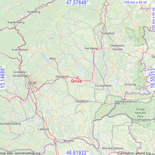
Gnies GPS coordinates[2]
47° 6' 0" North, 15° 51' 0" East
| Map corner | latitude | longitude |
|---|---|---|
| Upper-left | 47.57648°, | 15.14688° |
| Center: | 47.1°, | 15.85° |
| Lower-right: | 46.61922°, | 16.55313° |
| Map W x H: | 106.4×106.4 km | = 66.1×66.1mi |
| max Lat: | 48.98333° ⇑79.3% North |
| Gnies: | 47.1° |
| min Lat: | ⇓20.7% South 46.48841° |
| min Long | Gnies | max Long |
| 9.57802° | 15.85° | 17.1° |
| W 76%⇐ | ⇒24% E |
Elevation
Elevation of Gnies is 310 m = 1017 ft, and this is 195.5 m = 641 ft below average elevation for this country.
| Max E: |
2140 m = 7021 ft | 73.7% |
| Avg. | 505.5 m = 1658 ft | |
| Gnies | 310 m = 1017 ft | |
Min E: |
118 m = 387 ft | 26.3% |
See also: Austria elevation on elevation.city.
Geographical zone
Gnies is located in North temperate zone (between Tropic of Cancer and the Arctic Circle). Distance of this North polar circle is 2164.1 km =1344.7 mi to North.| Distance of | km | miles | from Gnies |
|---|---|---|---|
| North Pole | 4770 | 2963.9 | to North |
| Arctic Circle | 2164.1 | 1344.7 | to North |
| Tropic Cancer | 2631.1 | 1634.9 | to South |
| Equator | 5237 | 3254.1 | to South |


Nearby cities:
15 places around Gnies: (largest is in red/bold)
• Blaindorf
8.4 km =5.2 mi,  9°
9°
• Egelsdorf
3.1 km =1.9 mi,  306°
306°
• Gersdorf an der Feistritz
7.4 km =4.6 mi,  0°
0°
• Grosssteinbach
6.1 km =3.8 mi,  24°
24°
• Hainersdorf
7.3 km =4.5 mi,  76°
76°
• Hartmannsdorf
5.1 km =3.2 mi,  189°
189°
• Ilz
6 km =3.7 mi,  104°
104°
• Nestelbach im Ilztal
2.2 km =1.4 mi,  145°
145°
• Nitscha
7.8 km =4.8 mi,  283°
283°
• Oberrettenbach
6.7 km =4.2 mi,  325°
325°
• Ottendorf an der Rittschein
6.9 km =4.3 mi, 149°
• Prebensdorf
6.3 km =3.9 mi, 306°
• Pöllau bei Gleisdorf
5.3 km =3.3 mi,  225°
225°
• Sinabelkirchen
1.7 km =1.1 mi, 277°
• Untergroßau
3 km =1.9 mi,  273°
273°
Sources, notices
• [Note1] Compared only with cities in Austria existing in our database
• [Src1] Map data: © OpenStreetMap contributors (CC-BY-SA)
• [Src2] Other city data from geonames.org with taken over terms of usage.
• [Src3] Geographical zone / Annual Mean Temperature by Robert A. Rohde @ Wikipedia
